

Kedar dome Expedition in Garhwal Himalayas Uttarakhand
My Journey as a Liaison Officer on an Austrian Ski Expedition April-May 2025
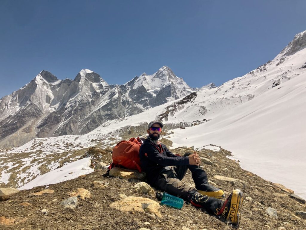
Hello, I’m Virendra Singh a local mountaineer from Garhwal Himalayas of Uttarakhand. I’d like to share my journey as a Liaison Officer on an Austrian team on Kedar dome Expedition with ski in Garhwal Himalay on Kedar dome. Being appointed as a Liaison Officer by the Indian Mountaineering Foundation (IMF) was a great opportunity to climb the peak and explore the Gaumukh Glacier and Kirti Glacier Valley a truly beautiful valley heaven on earth i would say, with prominent peaks like Mount Shivling, Mt. Meru, Mt. Thalay Sagar Mt. Kedardome, the unclimbed Mount Kharch Kund, on one side of the Gaumukh Glacier and other side stands the Bhagirathi Group, Mt. Thelu, and many other outstanding peaks, the valley is also known for Many beautiful treks like, Gaumukh Tapovan, Vasuki Tal, Kalindi Khal.
If you love reading about mountains & expeditions this blog is for you and it’s gonna be a great source of information, stay tuned to join me for another attempt and more stories from Himalay, so let’s get started
Night Travel Mussoorie to Delhi
April 15, 2025 | Altitude 2100 M .
My journey for Kedar dome expedition began in Mussoorie in the evening i traveled to Dehradun and took a night Volvo bus from ISBT Dehradun, reaching Delhi around 3:00 AM. I met my friend Rajesh, who was traveling to Manali for a trek, We had an early morning tea at ISBT Kashmiri Gate in New Delhi while waiting for daylight. We took the metro together for three stations. After that, Rajesh took another metro to reach his friend’s home and I reached the IMF office around 7:00am.
Expedition Briefing at IMF
Day 1 – April 16, 2025 | Altitude 226 M .
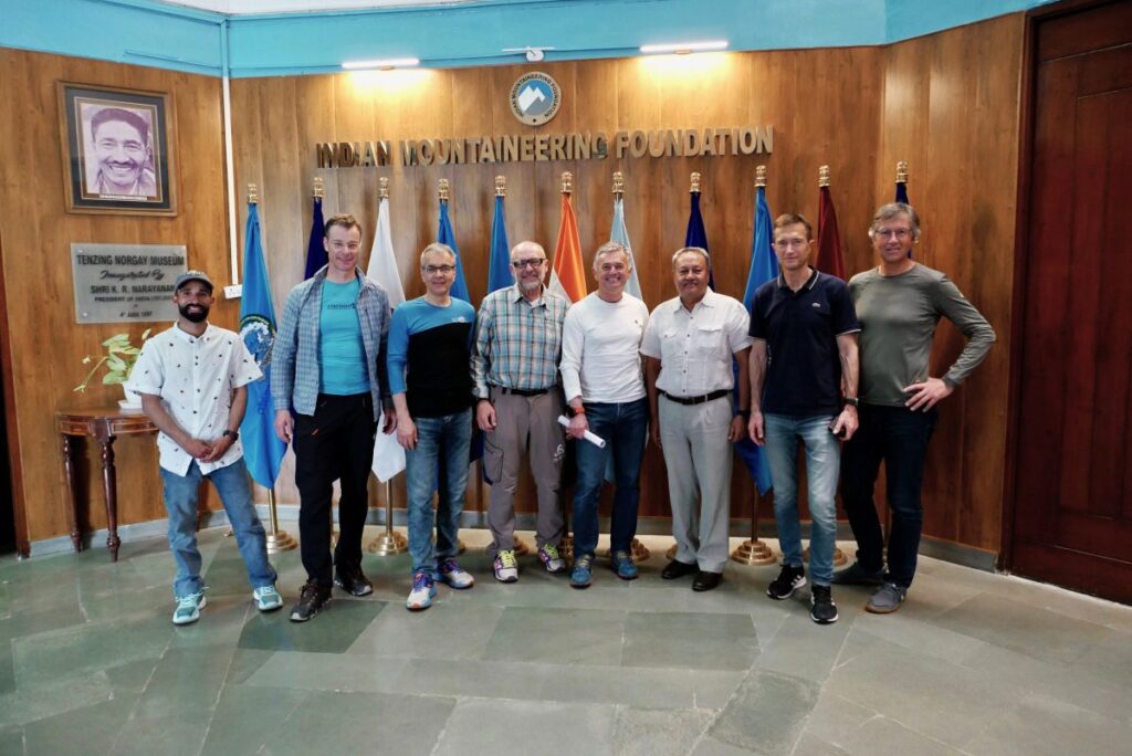
After waiting for an hour, the IMF office opened. I had a cup of tea and met the representative. About an hour later, the Austrian climbers and the agency (Shikhar Travels Leading Expeditions Company ) representative Mr. Vikash arrived, followed by a briefing session with Col Madan Gurung (Director IMF), We had a good chat with the team and completed all the necessary paperwork for Kedar dome expedition. Afterwards, the team returned to their nearby hotel. I collected all mountaineering gears from IMF store pecked my rucksack and spent the night at the IMF.
Journey to Rishikesh and Exploring the Spiritual Hub
Day 2 – April 17, 2025 | Altitude: 372M / 1220 ft | Temp. (30° to 40° C) | Drive 300 km
I went to their hotel loaded all the gear into our Volvo bus. After a group picture, we started our six-hour drive to Rishikesh and stopped for lunch and reached Haridwar by 3:00 PM, Rishikesh by 4:00 PM. Upon arrival, we checked into our hotel Neeraj Bhawan then explored the area, as we needed to purchase some additional supplies.
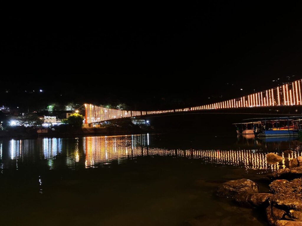
Rishikesh is a place imbued with spiritual vibes, making it an ideal destination for all kinds of travelers. Whether you’re heading towards Char Dham or embarking on Himalayan treks like Gaumukh Tapovan, Kedar Tal, Dodi Tal Darwa Top, Dayara Bhugiyal, Chopta Chandrashila, Shree Tungnath, Deoria tal, Rudranath, Madhyamaheshwar, Valley of Flower, Hemkund Sahib, Kagbhushandi Lake, and many beautiful treks in Uttarakhand, this is a perfect starting point. If you’re visiting for the first time and heading into the mountains, never miss the opportunity to explore Rishikesh. You should at least allocate a day to explore it before continuing your journey.
In Rishikesh, the magical vibes of the Ganga Aarti will cleanse your soul while you inhale the amazing fragrance of Dhoop and listen to the melody of the Aarti. Ganga River rafting will add an extra thrill to your trip, and the Beatles Ashram will connect you to the world of meditation. Depending on your interests, this beautiful city, with its thousands of temples and ashrams, has a lot more to offer. The foothills of the Himalayas gracefully welcome the holy Ganga as it descends from the Himalayas (heaven) to the lands of Yogis.
We all had dinner together and rest
Journey to Uttarkashi
Day 3 – April 18, 2025 | Altitude: 1500meter, Temp. (20° to 30° C) | Drive: 166 km
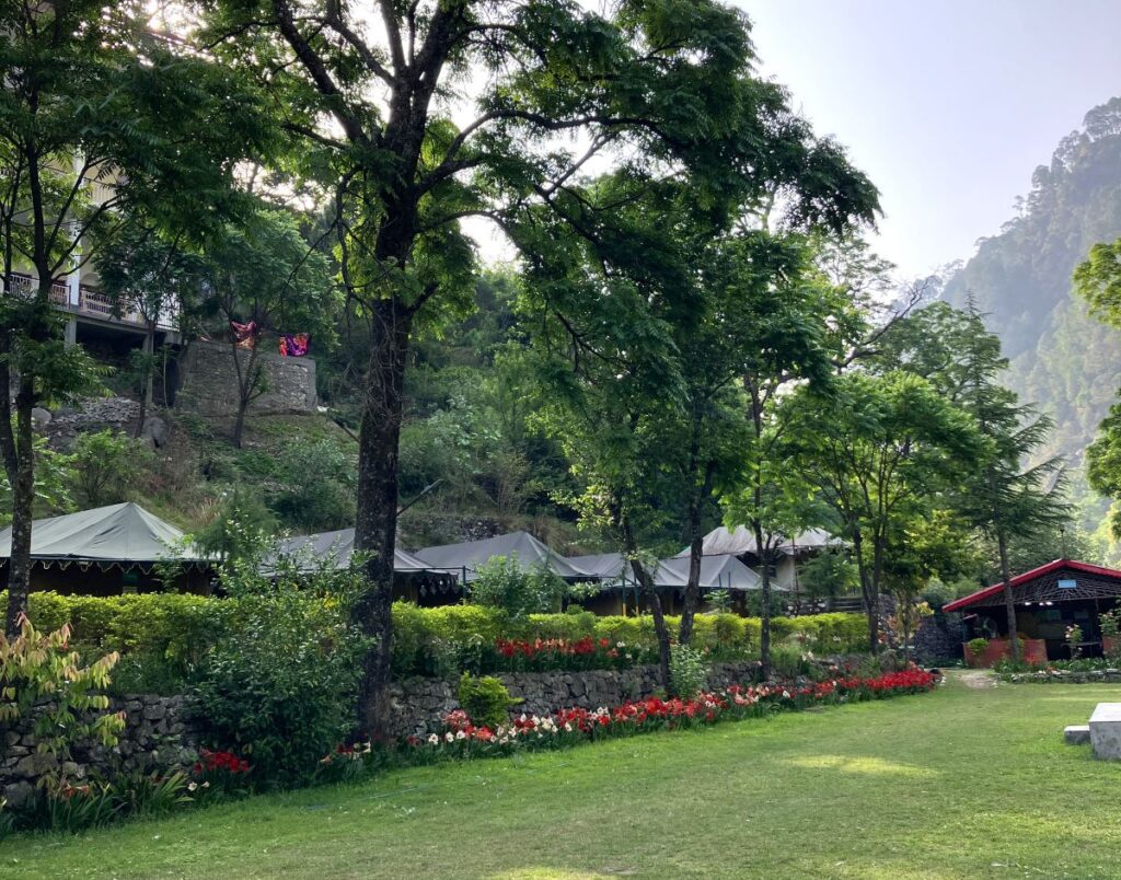
We started around 8:00 AM from the resort, driving through beautiful landscapes and places like Narendra Nagar, Chamba, the Tehri Dam, and Chinyalisaur. Reached Uttarkashi and checked into Shikhar Resort, nestled 3 km from the main town towards Gangotri. This is a beautiful location on the bank of the Bhagirathi River, surrounded by mountain landscapes and with a beautiful river in front. We checked into our tent huts and had a hot lunch.
Afterward, we met our expedition leader, Manohar Chauhan, also known as Maddy, he is a very experienced mountaineer from Uttarkashi, briefed us about the expedition and our further journey into the mountains. He has climbed more than 20 peaks in the Indian Himalayas. Maddy is a good mountaineer, always smiling, and possesses the positive personality a good mountaineer should have.
Along with Maddy, I visited all the relevant officials and submitted the information for our expedition. For any foreign expedition in the Indian Himalayas, it is compulsory to approach the IMF, which then seeks permission from the Forest Department and local authorities. In Uttarakhand, it’s mandatory to have permission from the Chief Wildlife Warden, the Director of the National Park (if the peak is located within one), the Divisional Forest Officer, and the District Magistrate. Before leaving for the mountains, it’s also mandatory to inform the SDRF, SP, and Air Force so they can provide help in emergency situations. I submitted the letters to all officials and then came back to the resort, explored the area, had dinner, and rested.
Journey to Gangotri last Road Head
Day 4 – April 19, 2025 | Altitude: 3000 meter, Temp. (10° to -2° C) | Drive – 97 km
After having breakfast at 7:00 AM, the team checked and loaded all the mountaineering equipment and logistics onto the bus. We had an early lunch at 12:00 noon at the resort and then started our journey to Gangotri, another 100 km drive that would take 4-5 hours. This road runs along the Bhagirathi River, passing through the base of the towering Himalayas of the Gangotri Region.
This journey offers outstanding views, including alpine regions, the Great Himalayas, village landscapes, farming fields, apple orchards, and beautiful Deodar forests. We also passed through the Harsil Valley, Gangnani (known for its hot spring water), beautiful hill towns like Harsil, and many old, traditional mountain villages such as Sukhi, Mukhba, and Dharali. The beauty of this journey will always keep your eyes open. I personally love this journey from Uttarkashi to Gangotri as it offers beautiful, refreshing mountain vibes.
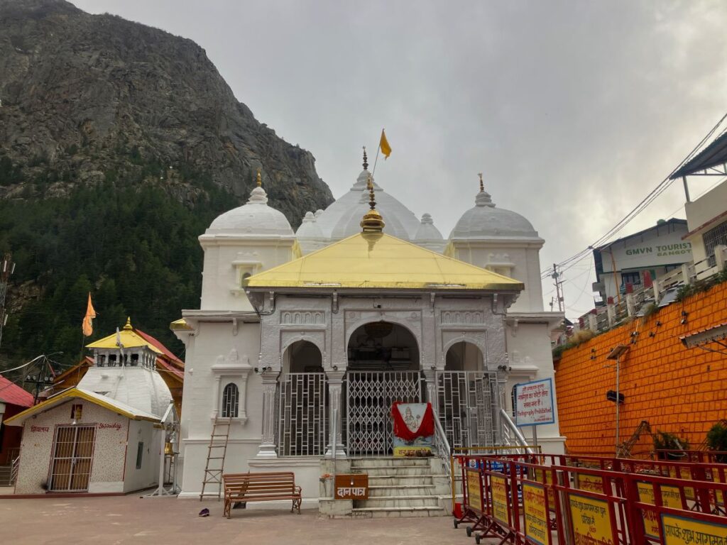
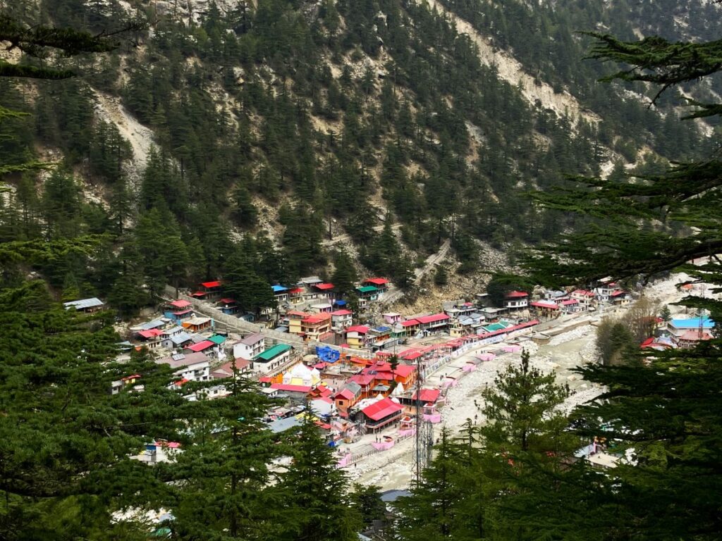
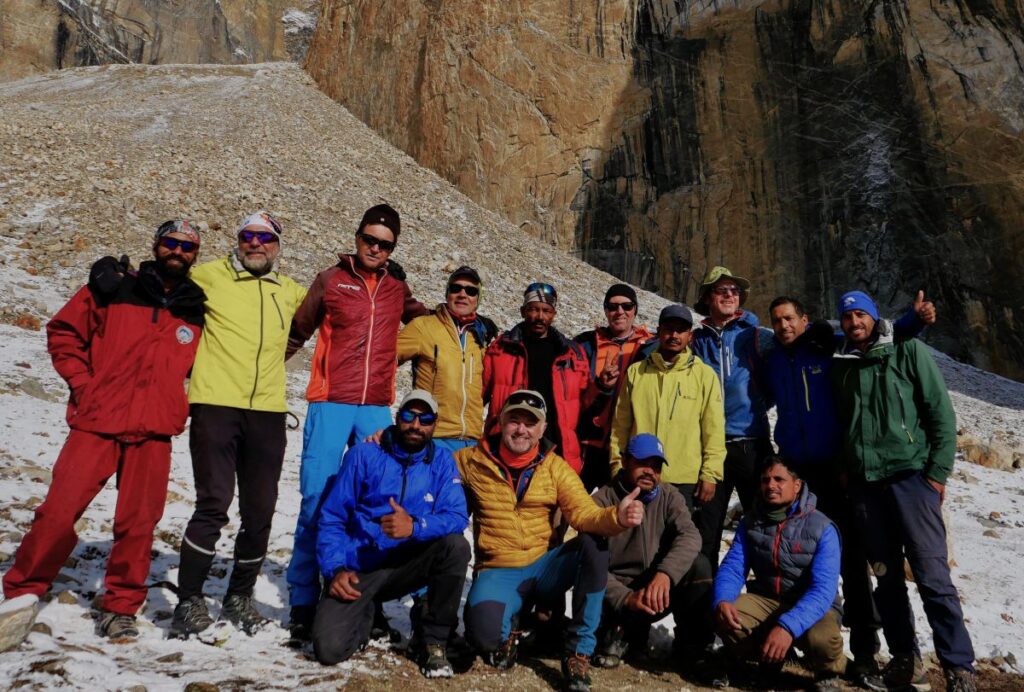
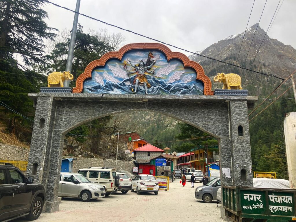
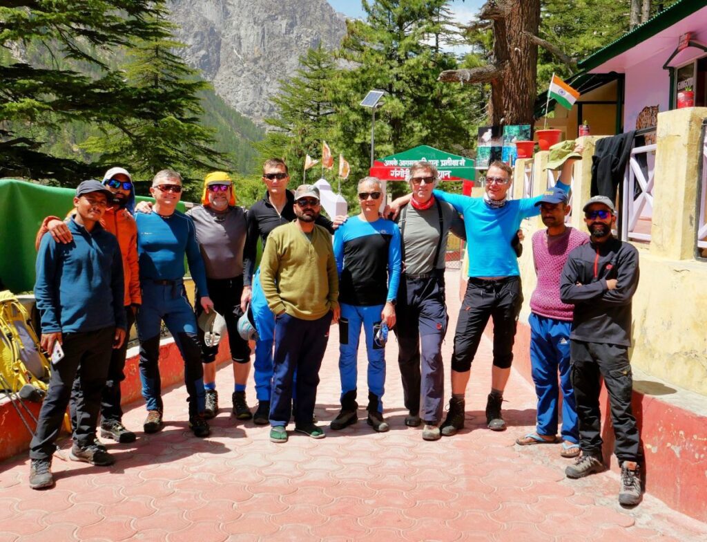
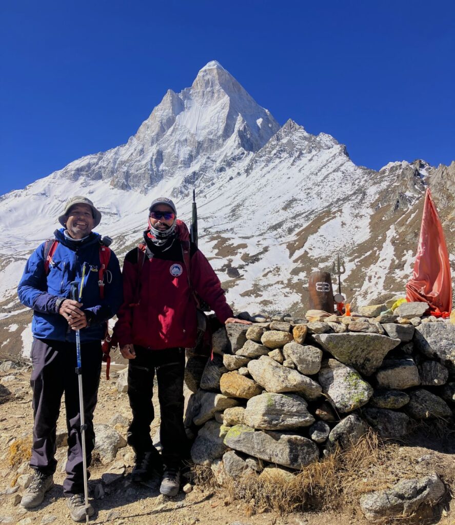
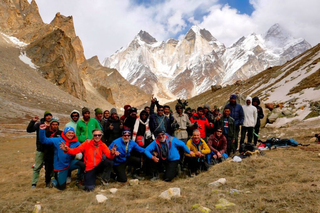
After five hours of travel, we finally reached Gangotri at 5:00 PM. Our accommodation was booked at Mandakini Guest House, near the Gangotri Temple, where the whole team was already waiting for us. The guest house was half a kilometer from the road, so all the porters came to pick up the Expedition luggage and climbing gear to take to the guest house. After checking in and having a cup of tea, we all went for a temple visit however it was not opened yet. We all came back and had dinner followed by team introductions with the other climbing members. Finally, the full team was ready Kedar dome expedition:
Base Camp Manager:
Manohar Singh Chauhan
Climbing Team:
Suresh Singh | Naveen Singh | Ankul Singh | Govind Singh Rawat
Liaison Officer
Virendra Singh
Cooking Team:
Kishan Dai | Sukhdev
Austrian Skier & Climber
STEFAN RIEBERER (Age 60) | WOLFGANG RABACK (Age 61)
HEINEZ HOEDL (Age 66) | SCHIEG FRANZ (Age 69)
BORIS PAPOUSEK (Age 60) | BORIS PAPOUSEK (Age 60)
BORIS PAPOUSEK (Age 60) | KLAUS POSCHL (Age 56)
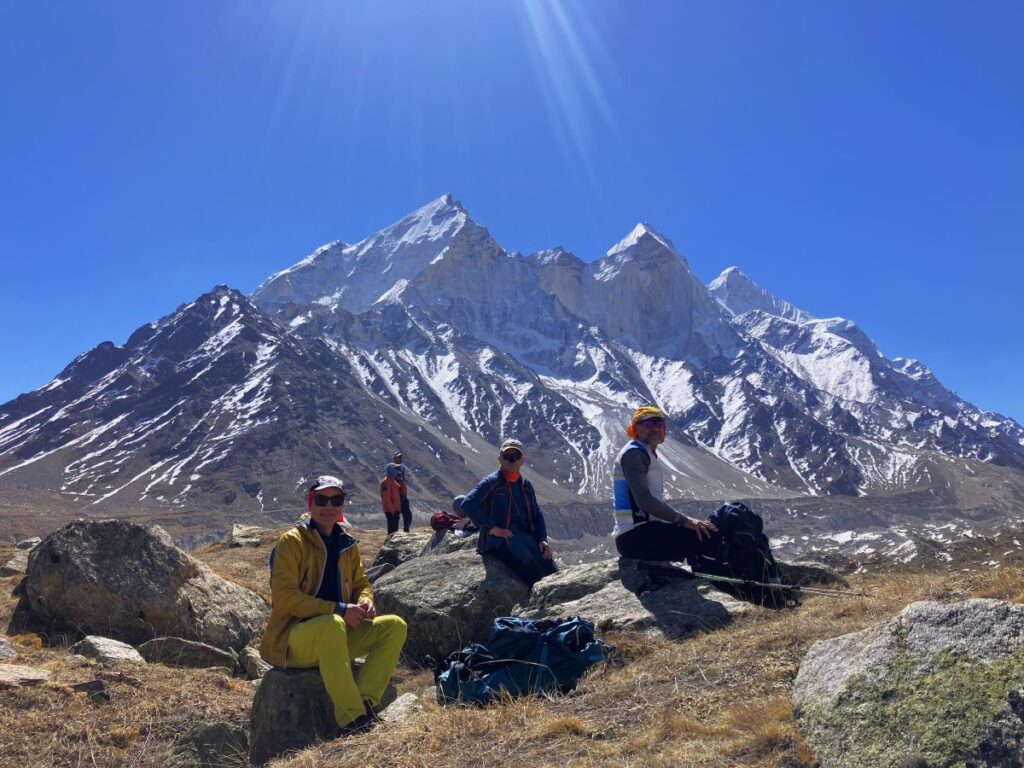
Acclamations day at Gangotri
Day 5 – April 20, 2025 | Altitude: 3300 meter, Temp. (10° to -3° C)
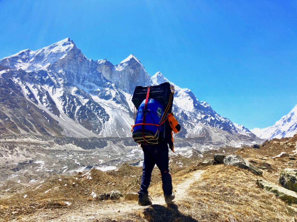
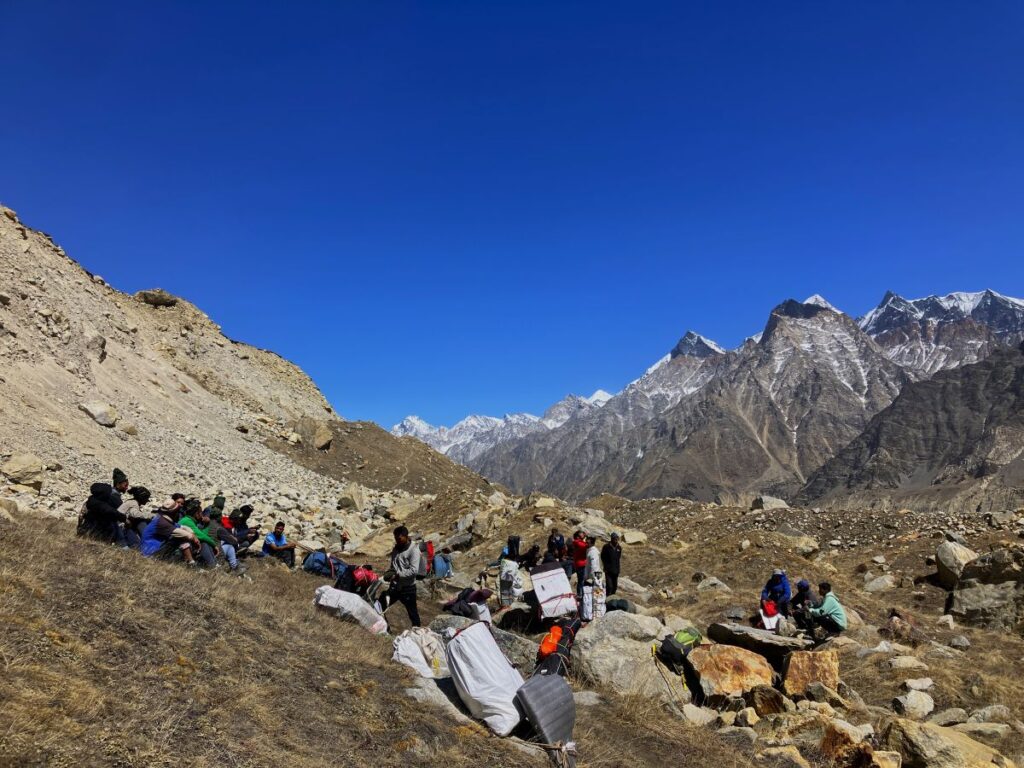
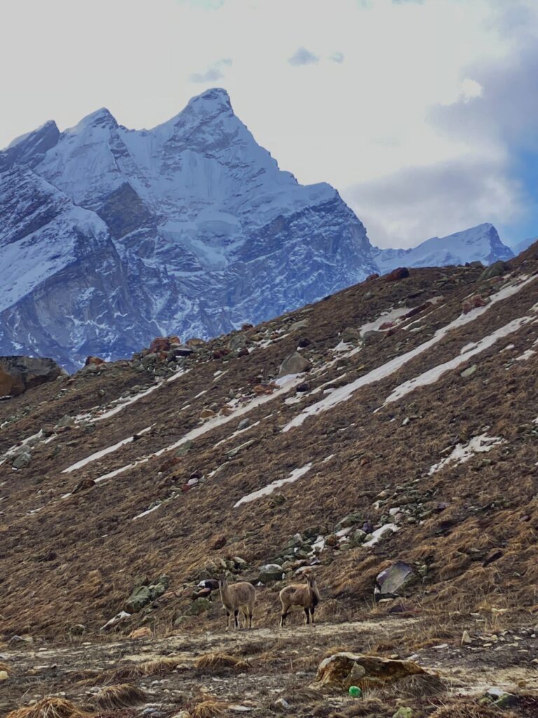
The day started around 8:00 AM, Govind took us for an acclimatization trek towards the Kedar Tal trek we all hiked for two hours, gaining 300 meters through beautiful landscapes then returned to the Gangotri Museum before lunch. As the next day was the first day of the expedition, we organized all our equipment and rechecked if everything was okay. Forty high-altitude porters were hired to carry the entire expedition’s logistics until the base camp three-day trek.
Why it is very difficult to get permit?
To be honest i don’t know but would like to share what happened when we were approaching to climb. As weather prediction was not good, and permission for trekking in the region was canceled by the DM (District Magistrate) of Uttarkashi. When we talked to the DFO (Divisional Forest Officer), he stated, “Without DM permission, we can’t allow you further.” Although the weather wasn’t that bad, the Uttarkashi DM denied permission for any movement in the mountains for the next few days in the region. As we all know in mountaineering, every single day is crucial; staying back one day could jeopardize the whole expedition. Just imagine how poorly managed our tourism departments, forest, and local officials are! A group of six skiers and climbers applied for permits a year earlier to the IMF (Indian Mountaineering Foundation). The IMF then approached all related authorities like the Chief Wildlife Warden, DFO, and Tourism Secretary, and got the permits ready after all documentation. They spent 30-40 lakhs for the expedition, booked their air tickets, and traveled to India. Then, after a 500 km road trip to the last roadhead, Gangotri, they were ready to approach the expedition with all their equipment, professional mountaineers, local guides, an insured team, emergency backups, and had informed all departments for emergency assistance. Yet, at the entry gate, security says, “You are not allowed further as the DM has postponed all permits and movement based on a weather prediction. How terrible, to be honest! As an Indian Liaison Officer, I felt ashamed in front of the guests after telling them about the permission cancellation. As a tourism state, we must work on such issues, especially if our primary source of income comes from tourism and guests are spending Euros, which somehow helping the state’s economy and departments are hesitating to help and allow them in, The amount of struggle for getting permits is significant in our state; you must have noticed it in many places. I personally feel all these National Park authorities act like they are the owners of the land, but they should not forget that they are there to protect and serve, not to act like owners without realising Visitors efforts (especially who had travelled from abroad) to reach there, This is one reason why we are not developing mountaineering in our state, I agree there are some certain things and guidelines which department has to go through but they should also think of travelers struggles and safety. I spoke to the Director of the National Park, and he understood the situation. He was a nice guy and said I can allow the expedition up to Cheer Basa, 6 km from Gangotri. Once the DM gives permission, you can proceed with the expedition.
Gangotri to Cheerbasa
Day 6 – April 21, 2025 | 3572 meters/11720ft | Temperature 10 ° to -5°C
Trek 6km Ascent 572Meters / 1876Ft. (4 hours)
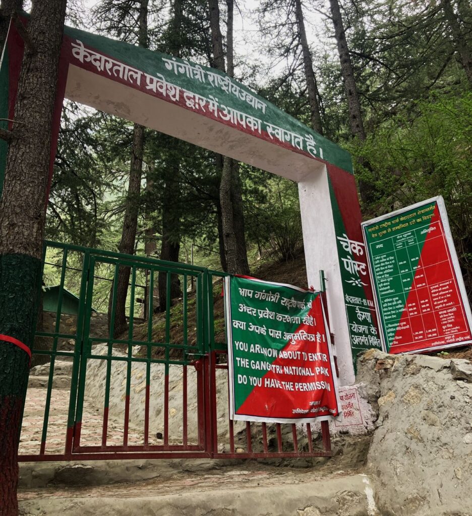
We packed our personal gear and packed lunch, starting the trek around 10:00 AM. After 30 minutes, we reached the check post. We signed the register and showed the passports of all climbers, then continued the hike
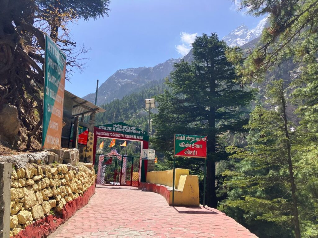
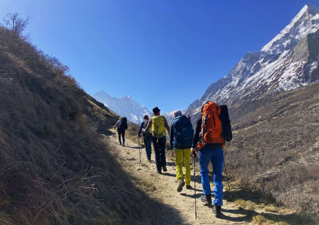
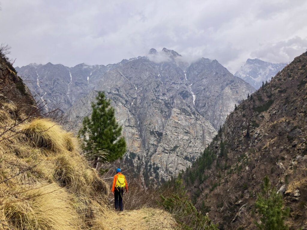
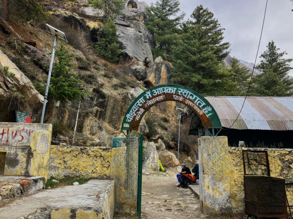
The trek to Cheer Basa is a gradual climb offering beautiful forest views. The trail is broad enough to walk comfortably and follows the northwest side of the Bhagirathi River. After trekking a few kilometers you’ll see the first glimpse of Mt. Sudarshan Peak in front, this trek to Cheer Basa is surrounded by Deodar, Bhojpatra, Firs, and pine trees. The colors of the forest, towering mountains, and the sound of the Bhagirathi River will ensure you don’t get tired and remain engaged in admiring the beauty. After for 4 hours of trek we reached Cheerbasa around 2:30 PM. As per the revised plan the team set up the campsite here.
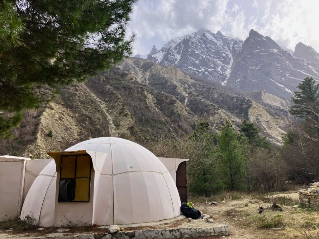
I loved this place surrounded by many pine and Bhojpatra trees. The name “Cheer Basa” comes from the local word for pine tree, which is “Cheer.” There are some settlements made by the tourism and forest departments that regular trekkers use for overnight halts if they don’t want to hike too long. We found a snow dome and used it for our kitchen and sleeping, and pitched three dome tents and one dining tent for guests; the rest of the climbing members used the dome to sleep overnight. We were already in a no-network zone, so we used a satellite phone to connect with one of our resource persons in Uttarkashi. He said permission to move forward was still not granted, as the DM’s office was too busy to communicate. He said he would go the next morning to get the permissions.
Cheerbasa to Tapovan
Day 7 – April 22, 2025 | 4310 meters/14140 ft | Temperature 8° to -6°C
Trek – 9km | Ascent 738 meters / 2441 ft. | Duration- 7 hours
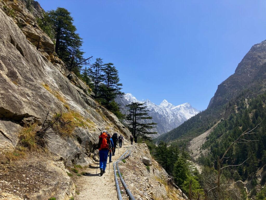
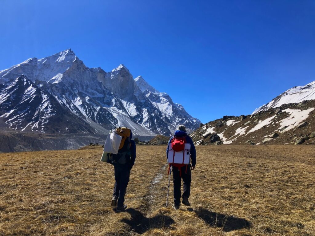
The following morning, the leader decided that while permission was being processed, the team could at least cover the distance to Bhojbasa, as today involved a long and difficult trek to Tapovan. The hand-pulling trolley had not yet been deployed, meaning the team might have to cross the river using ropes or over a snow patch on river if there is enough snow. After packing up the campsite, I along with the guests started the trek to Bhojbasa. Manohar and the porter were far behind, as they had to pack everything and begin their trek with the load, which meant it would take them another two hours to reach Bhojbasa. Ankul, Suresh, and Naveen went ahead to check the possibility of crossing the river, which was 3 km away; they were expecting snow over the river so the team could go across.
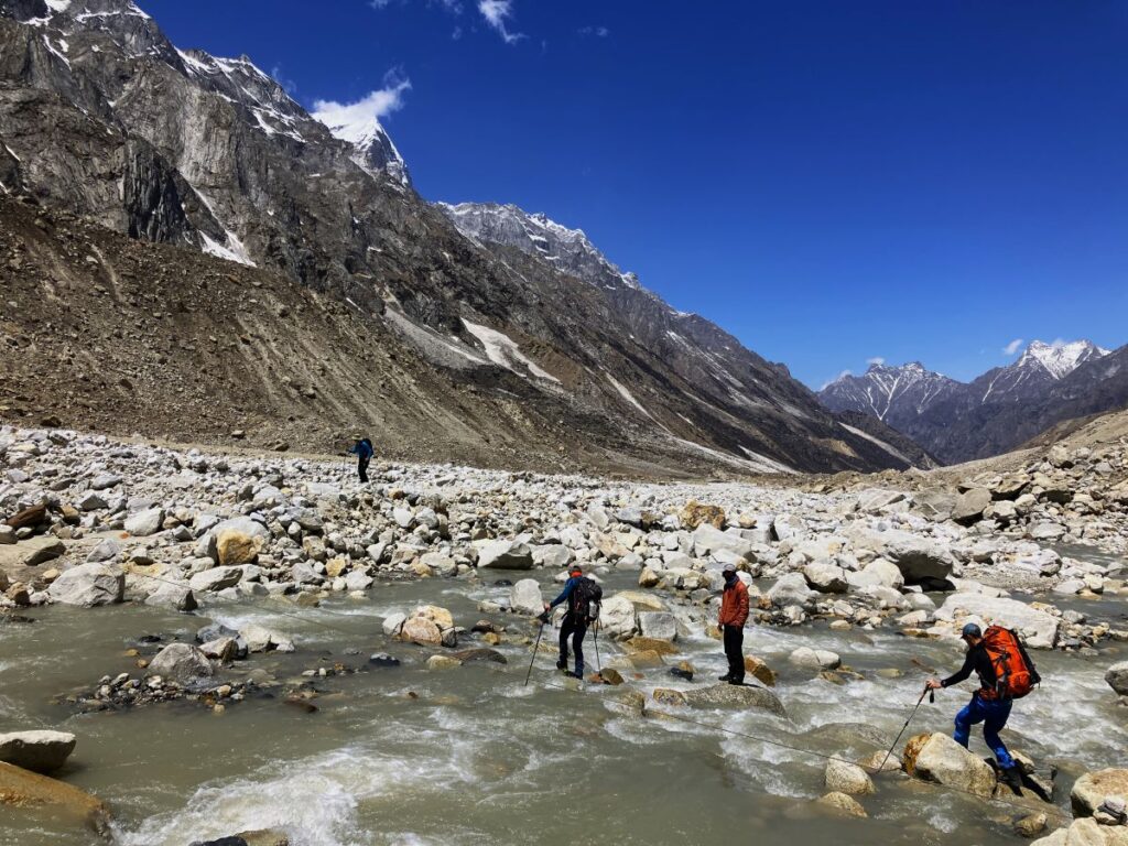
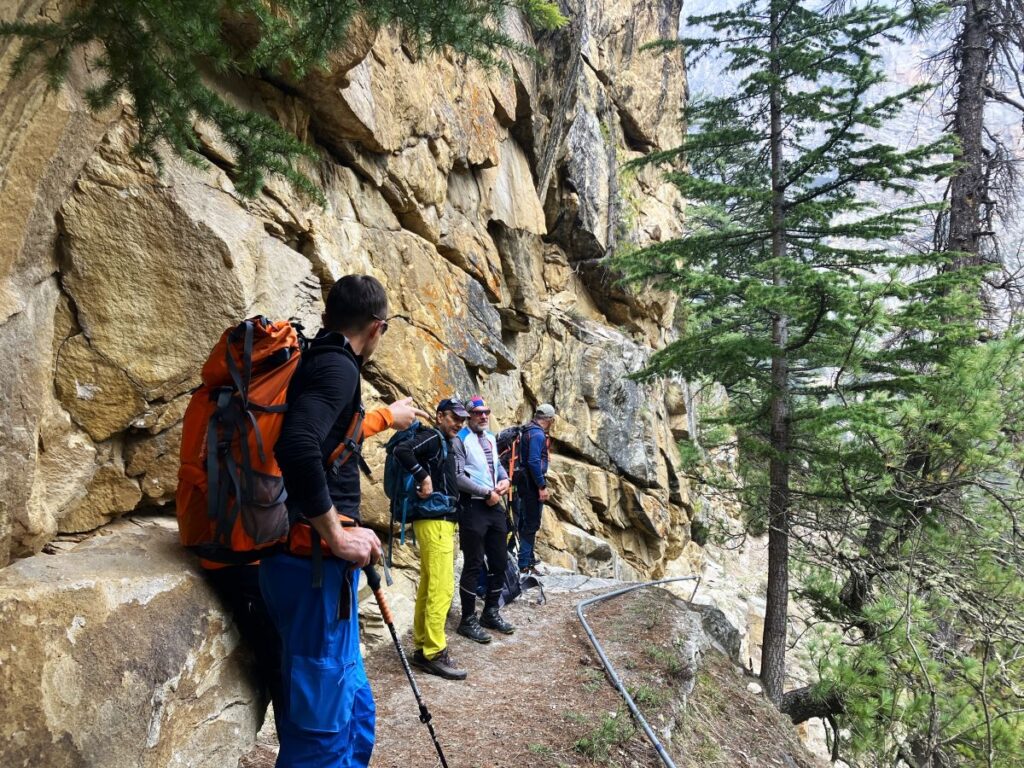
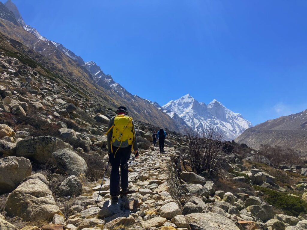
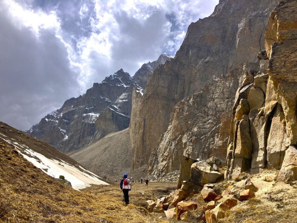
I was with the guests at Bhojbasa, debating whether we should wait for Manohar and his team before proceeding or at least cross the river. I wasn’t sure if permission had been granted for further travel I considered contacting Manohar who was in touch with the Uttarkashi office but I had no means of communication. I thought of crossing the river and climbing to Tapovan and wait, so we proceeded to the river. There was no snow to walk over or cross the river. Ankul and Naveen fixed the rope to hold onto and cross the river. We all cross the river and continued the trek, another steep uphill 3 km to Tapovan. This is a dangerous rockfall area and the most risky and difficult part of reaching Tapovan. Suresh and Naveen were leading and climbing 500 m ahead. After following them for about 1 km, Suresh whistled and shouted, “Rockfall!” Suddenly, big boulders along with 100s small rocks started falling down from the slope just a few meters ahead. We quickly hid under big rocks on the path and waited until it stopped. After a minute, it stopped falling. We then proceeded with the climb, after carefully looking up the mountain slope, where we saw a group of blue sheep who had triggered the rockfall a few minutes back. We quickly crossed the patch and reached an area where Akash Ganga was flowing down from Tapovan. This was also a steep uphill climb along this small river. As I was climbing at the last of the group there were a steep rock step which everyone climbed and passed when i was approaching the step the second-to-last climber ahead of me stepped on it and it just came out and quickly tumbled towards me. He shouted, “Rock!” I quickly jumped off the trail. It was very scary; if I had delayed even two seconds from the trail, I would have been crushed under that big rock. I was lucky thanks to Lord Shiva. After another 1 km climb, we reached Tapovan around 2:00 pm
The moment I finished the climb, I saw Mt. Shivling touching the sky in front, and a steep wall on its right side going through the clouds to touch the sky – Mount Meru this amazing view took away all our tiredness, After climbing a little more a big meadow of Mighty Tapovan open up a perfect place to set the camp, after walking 500 meters on the Meadows we choose a place to put the camp near Moni Baba’s stone hut close to the spring on a beautiful location we all took a little rest drink some water while some of the porters were approaching the river and steep uphill to reach the camping ground of Tapovan after 1 hour some porters reached with tents we started pitching them, cooking team arrived and start preparing evening soup and dinner one by one all porters reached around 5 pm.
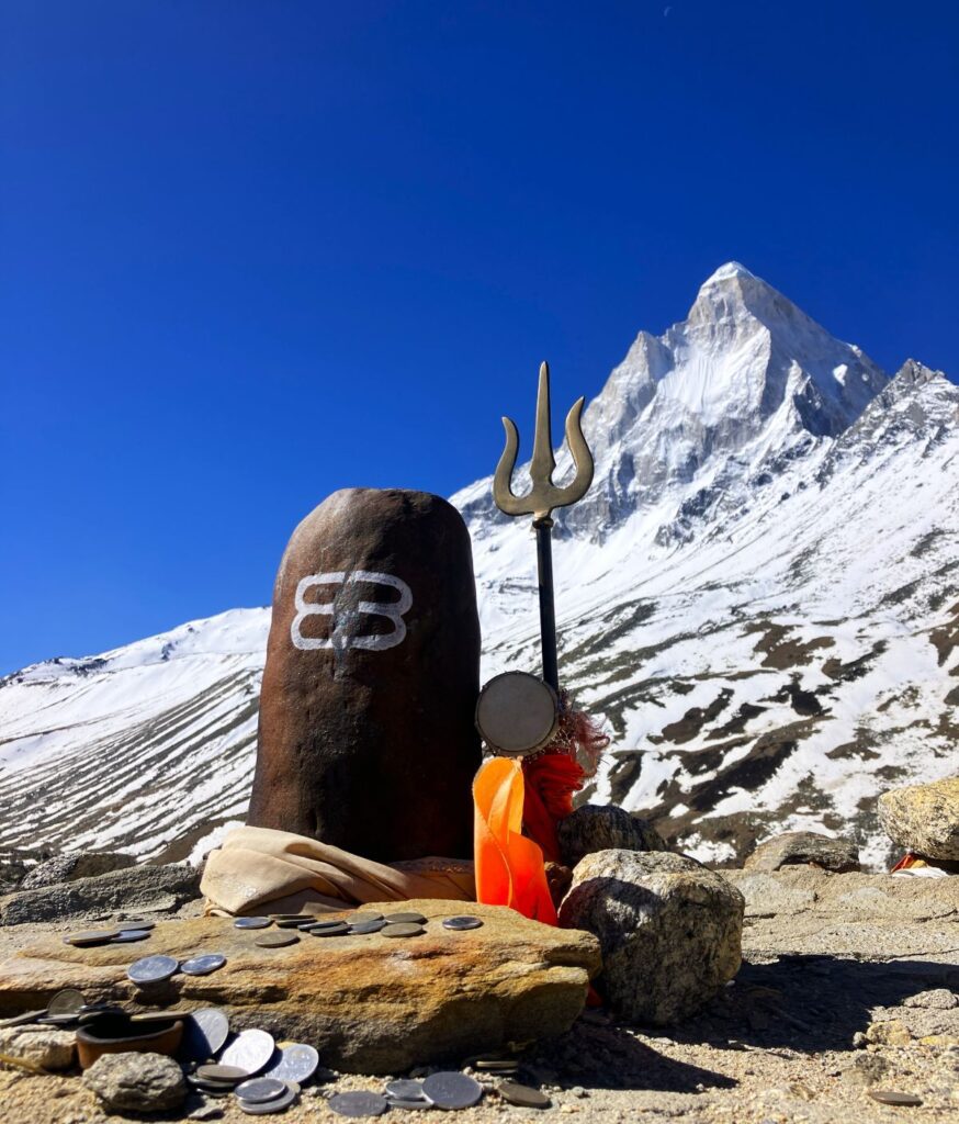
I was resting in tent and got a call rom from the kitchen tent LO sir tea is ready, i put on my Jacket and entered the tent Kishan Dai gave me hot cup of Black tea i was feeling mild headache due to elevation gain an i felt better after few ship of tea, everyone were inside discussing tomorrow plan, After call to Uttarkashi we got to know the permission is still not Granted as DM was busy, anyway now we were already quit fare and no idea what do, I discussed with Manohar that we should not proceed the expedition if permission is not given by all however we had the permission of Chief Wildlife Warden, so we decided to camp at Tapovan and ask one more time at DM Office next morning if they don’t respond we will rap up everything and return back to Gangotri, After tea we setup the everything had dinner and sleep well as all of us was tired
Tapovan to Kedardome basecamp
Day 8 – April 23, 2025 | 4610 meters/15124 ft | Temperature 5° to -6°C
Trek – 9km | Ascent 900 meters / 984 ft. | Duration- 7 hours
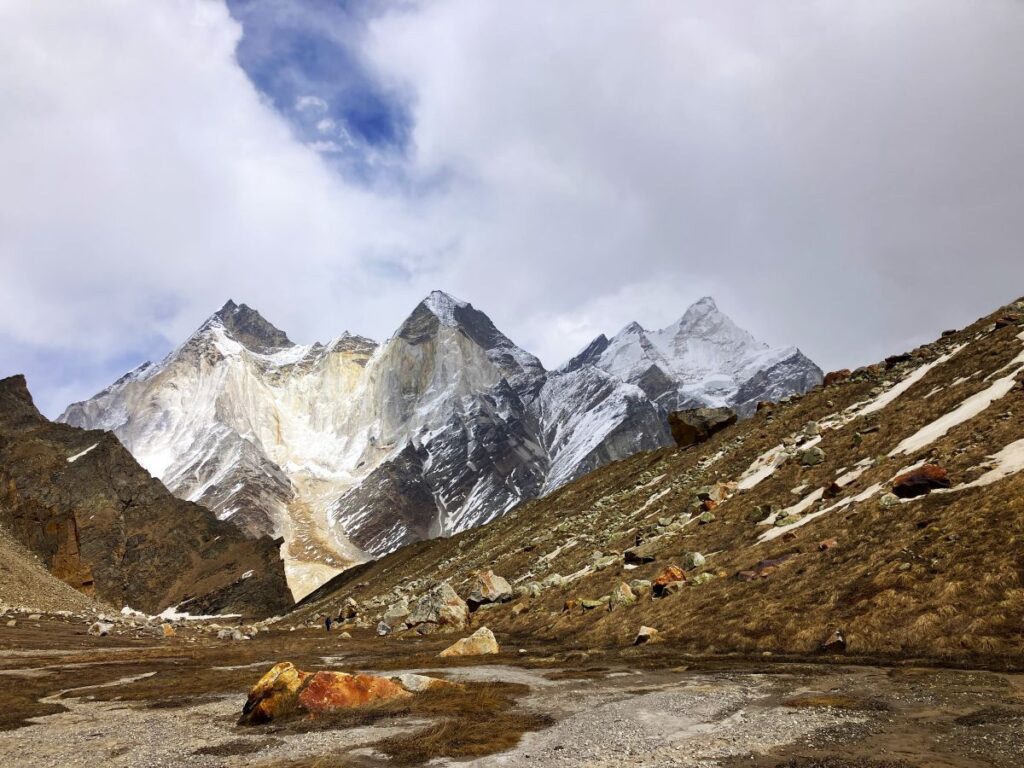
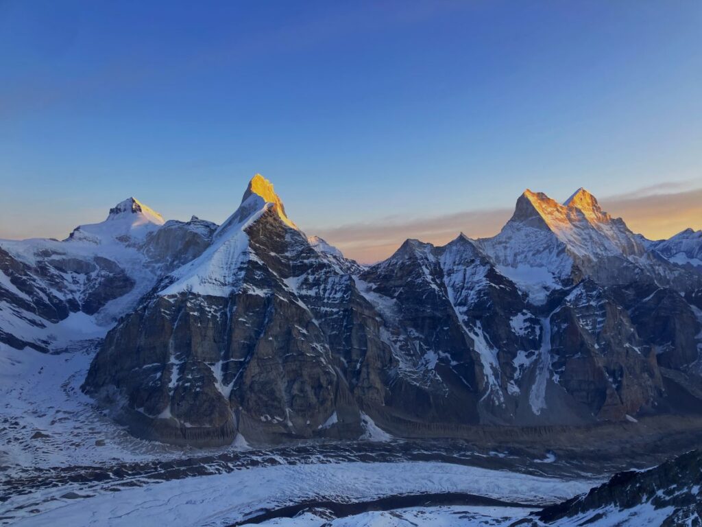
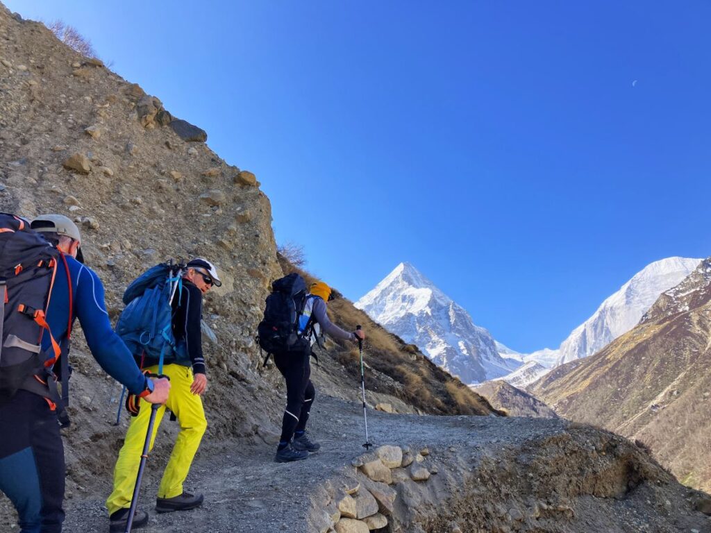
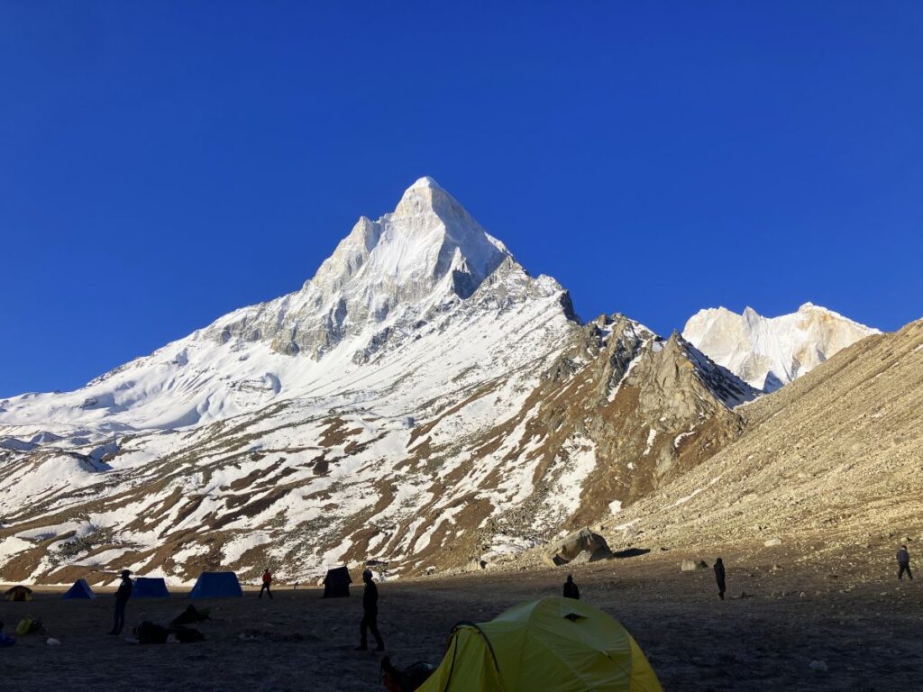
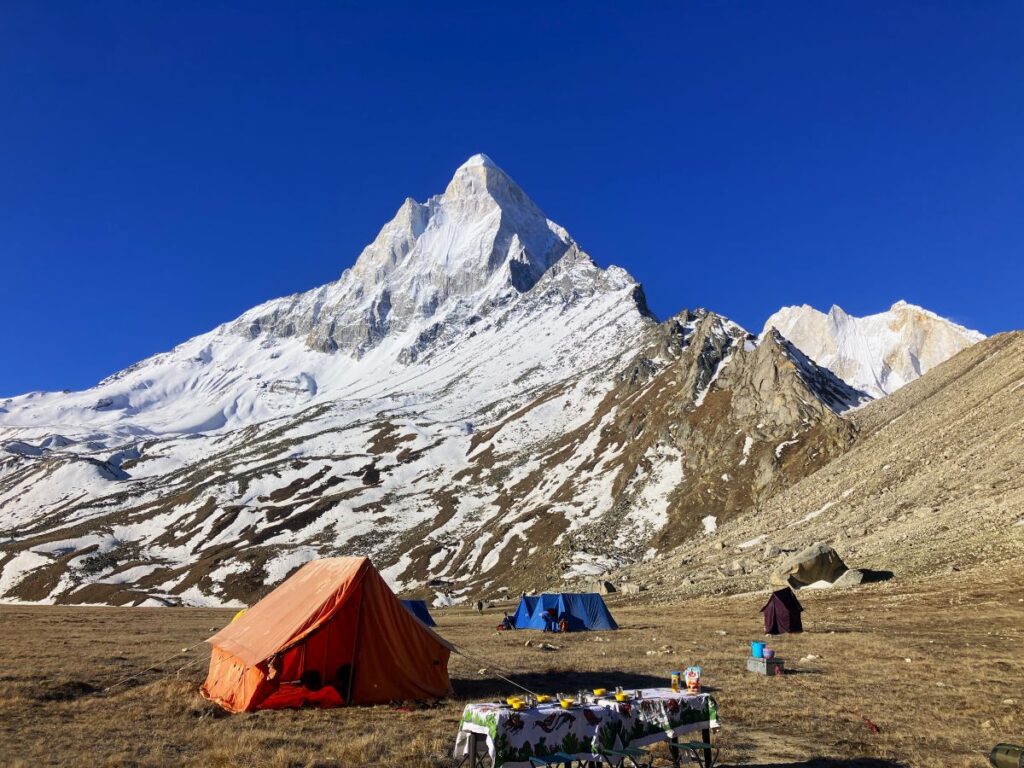
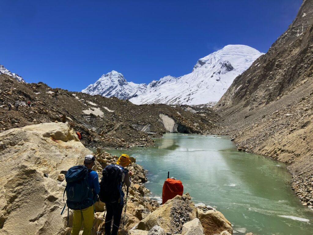
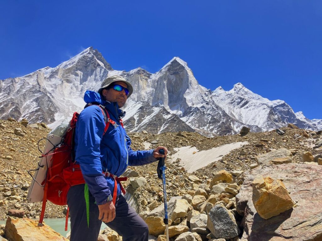
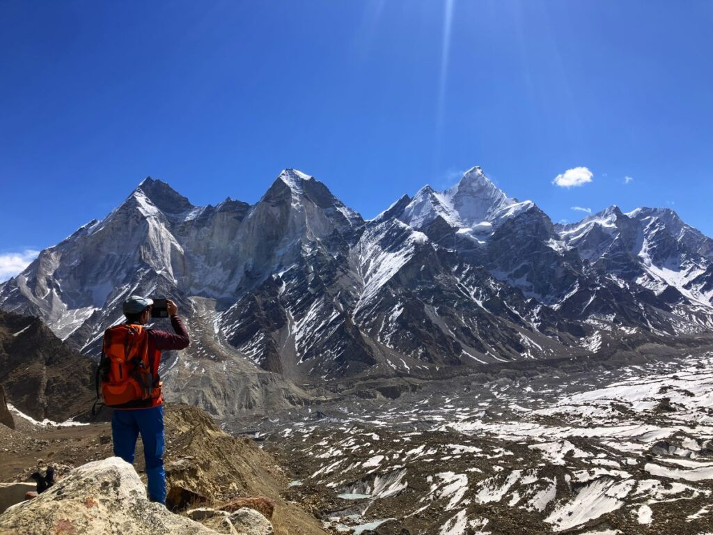
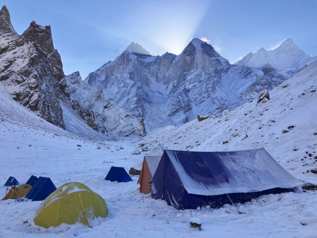
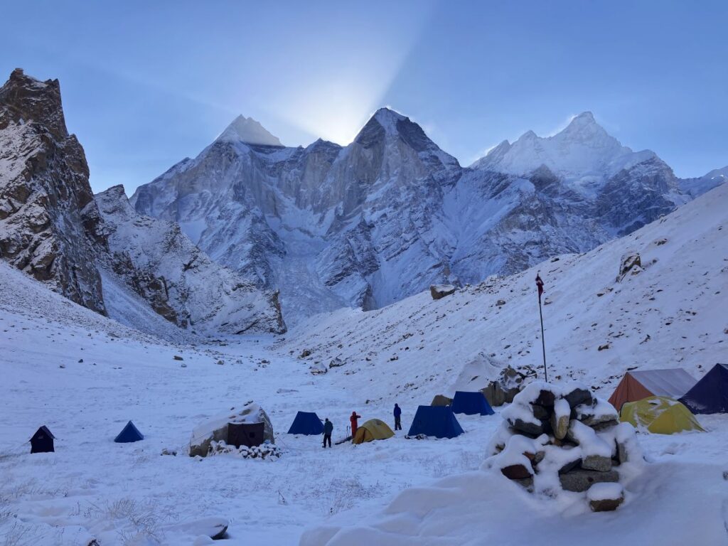
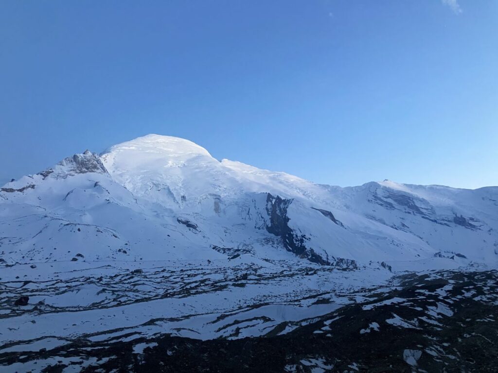
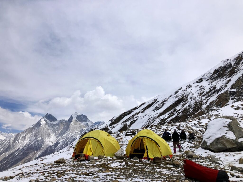
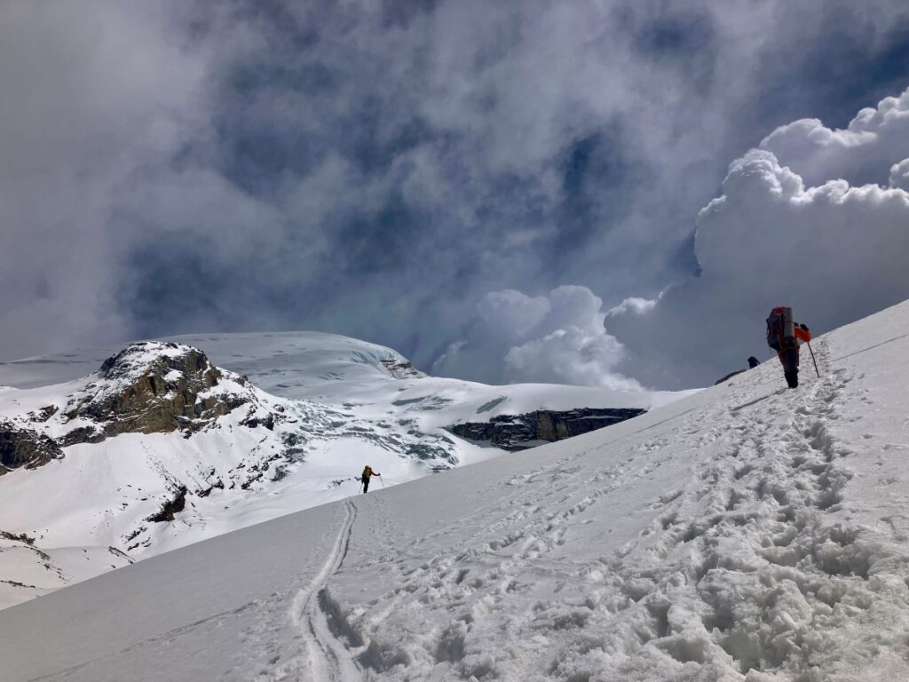
I woke up around 6:00 am and got out of the tent. The view was outstanding, as the morning sun illuminated the tops of Mount Meru and Mt. Shivling. The sun was rising from behind the Bhagirathi, creating a refreshing view. The golden light made all these mountains look magical. After tea, we had breakfast and started packing all our gear. By 9:30 am, we had packed our lunch and were ready to leave. After contacting Uttarkashi, permission was finally granted to proceed with the expedition, and we continued on to the Kedardome Base Camp. The trek to Kedardome Base Camp is a thrilling experience. The distance is around 9km, but it takes about 5 hours. After a 4 km trek from Tapovan, the trail descends to the Gaumukh Glacier and continues for 3 km along the right side of the glacier over the moraine. This part is very challenging as it is a rockfall area. In the mountains, rockfall is one of the most common hazards, and we should always be very careful. Any small mistake or lack of awareness can cause a major accident and end the expedition. On this route, you can hear the sounds of rockfalls every minute. We all passed this stretch carefully. After covering the 3 km distance over the glacier moraine, we reached the junction of the Kirti Glacier and the Base Camp. This point is also the diversion for Sundarvan and the trek to the Chaturangi Glacier. Finally, after a challenging 5-hour trek, we reached the base camp around 2:30 pm.
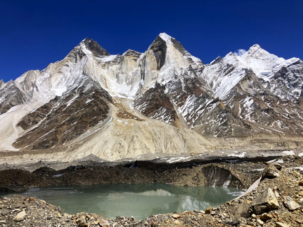
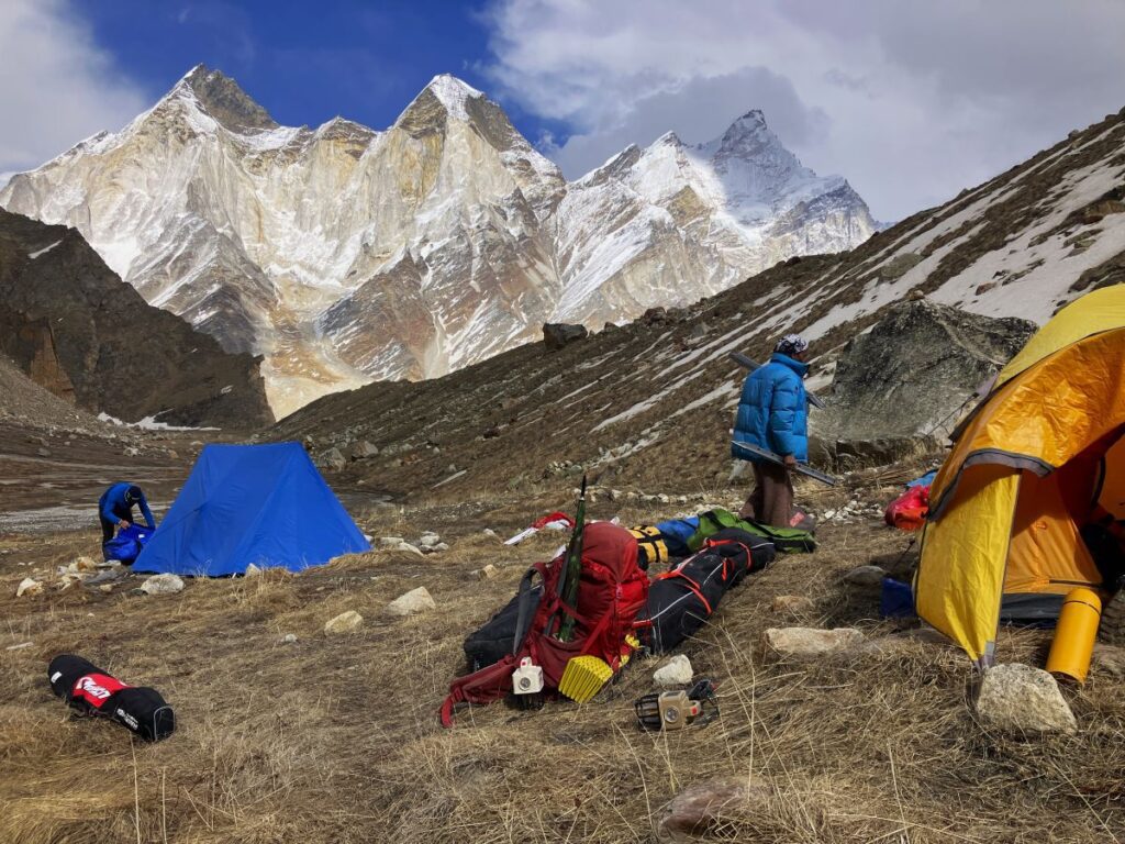
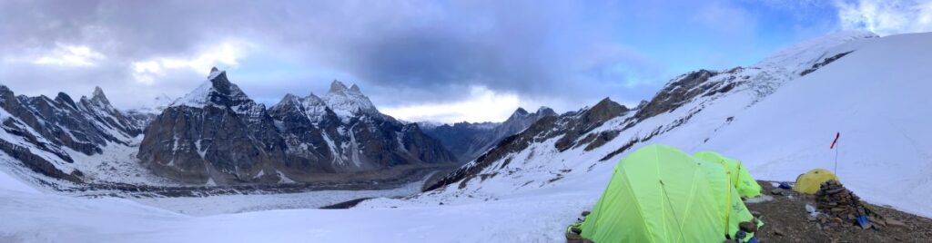
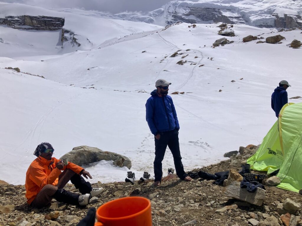
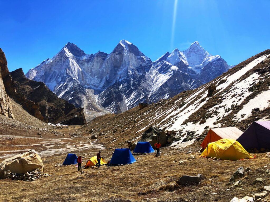
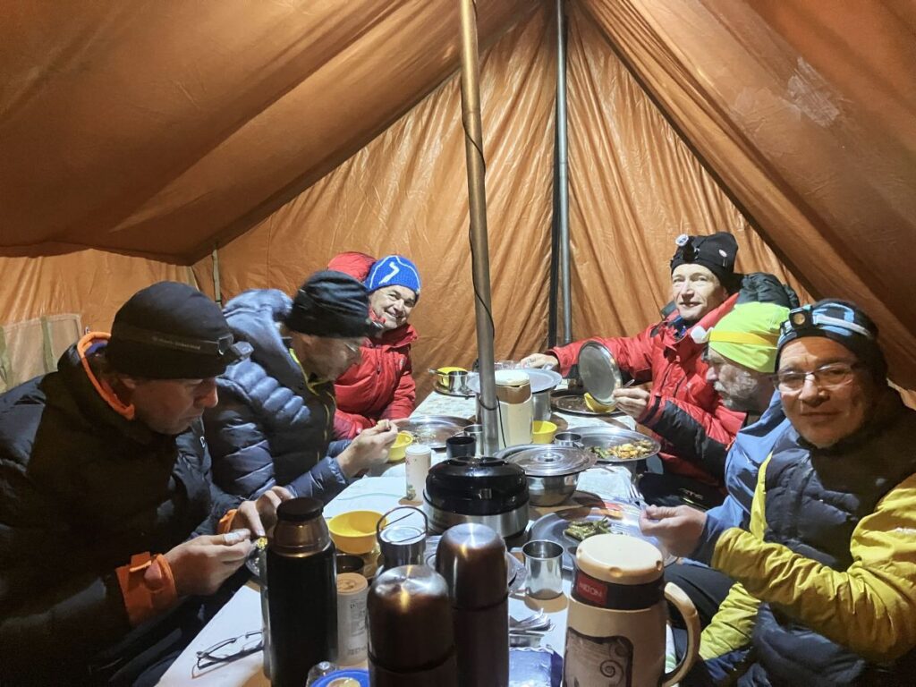
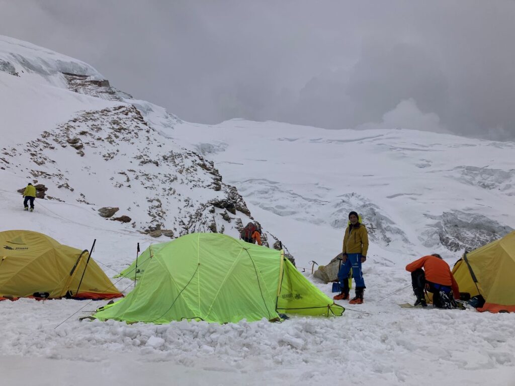
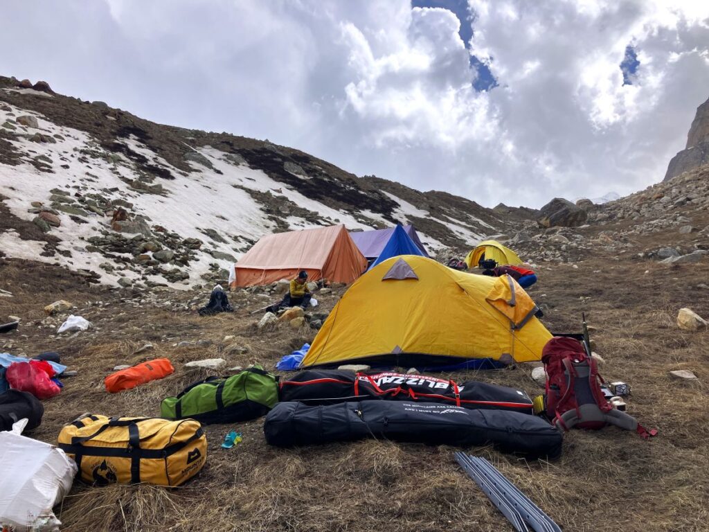
Kedar dome Base Camp is a beautiful meadow surrounded by rocky mountains. The Bhagirathi group stands on the eastern side, past the Gaumukh Glacier, with Mount Kharch Kund and Mount Kedardome. The southern and western sides are covered with a massive rocky wall. The camp was set up next to a ridge about 60 meters tall and a kilometer long. This ridge helps to block the windstorms coming from the Kirti Glacier and Kedardome, making it a perfect location for a base camp. As we reached the location, we changed out of our hiking clothes into warm clothing, drank some water, and started pitching the tents. Since all the porters were supposed to leave the same day, we asked them to help us set up the camp. We pitched one kitchen tent, one dining tent, three two-person tents for six clients, one dome tent for Manohar and me, and another dome tent for Govind, Ankul, and Naveen. Kishan Dai, Sukhdev, and Suresh Dai used the kitchen tent, which I would say was the best tent because we all gathered there for amazing chats while having tea, soup, and daily meals. Once the camp was almost ready, the guests asked all the porters to gather and thanked them for carrying all the expedition logistics. They also gave them some cash as a reward. Then, we all arranged our stuff, and the guests went for an acclimatization hike while the cooks prepared dinner. They came back and had dinner, and after a short briefing about the upcoming days, we all had a good sleep at base camp, as it had been a couple of tiring days with unknown obstacles and challenges. Finally we were all ready to approach the peak and start planning the further climb.
Kedardome Basecamp
Day 9 – April 24, 2025 | 4610 meters/15124 ft | Temperature 7° to -6°C
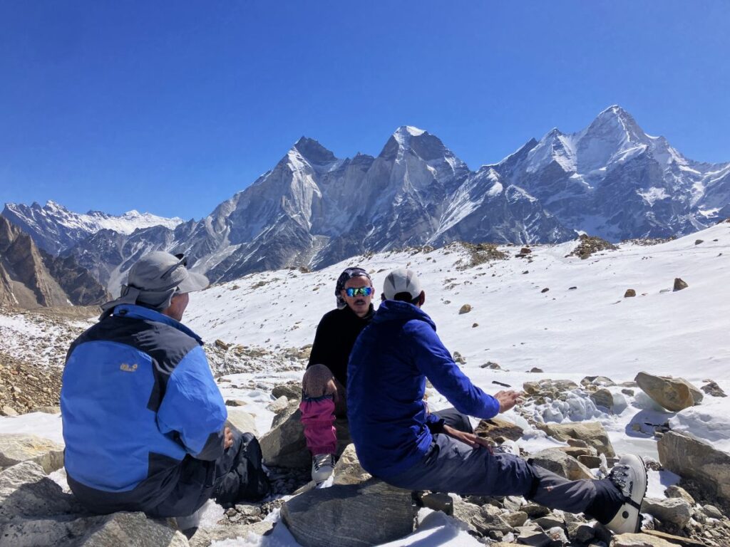
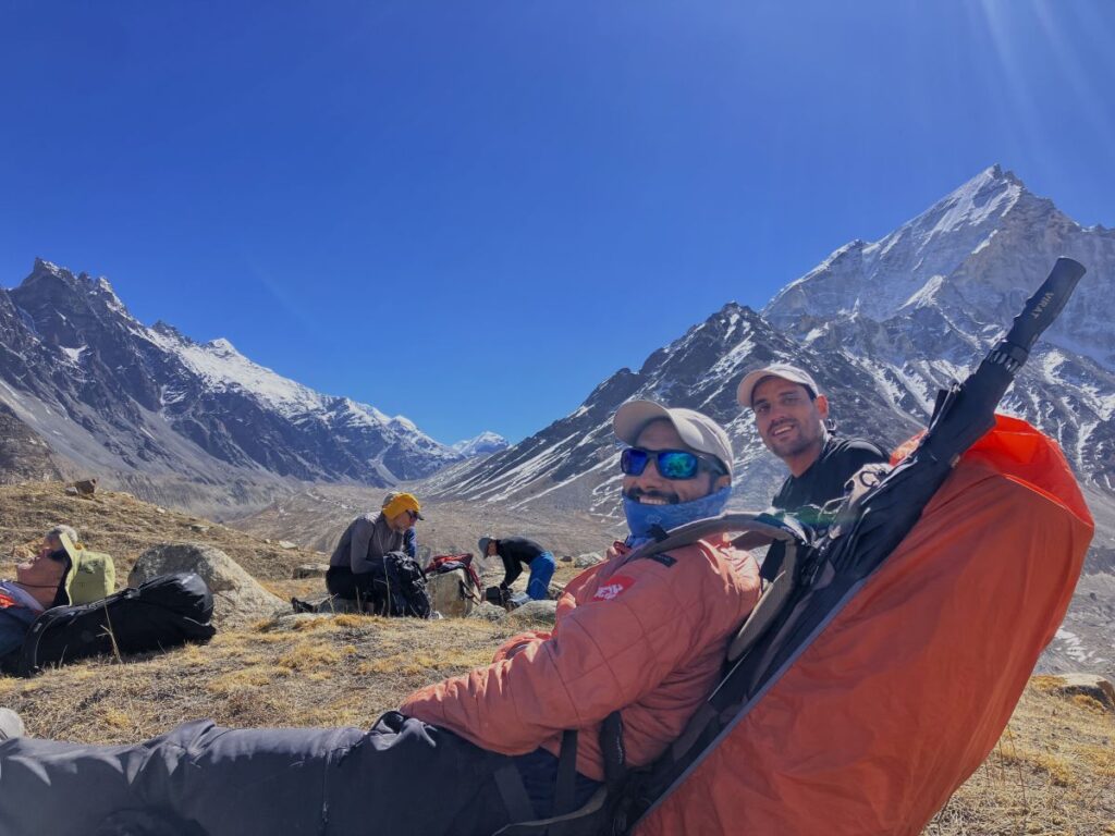
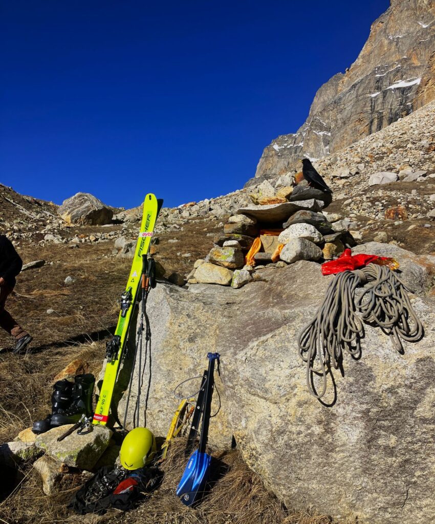
After waking up around 7:00 am, we had breakfast. The climbing team—Suresh, Ankul, Naveen, and Govind—worked to open a hiking route to ABC (Camp 1) and dropped some equipment there at 4,910 meters. Meanwhile, guests and I explored and opened a different route to cross the moraine and reach the snowy area over the Kirti Glacier. Their plan was to use skis to reach ABC the next day. This alternative route was longer, but it had more snow and glacier area, making it better suited for skiing. So, we now had two routes to reach ABC and cross the glacier. One was shorter but less suitable for skis, while the other was longer but ideal for skiing. All of us returned to base camp for lunch. I took a two-hour nap. Around 5:00 pm, the entire team gathered for tea. We had an amazing session of sharing stories and experiences, which was our daily routine. I’d say this is one of the best parts of any expedition, and it was especially great with this team, who were fantastic and had hundreds of stories to share.
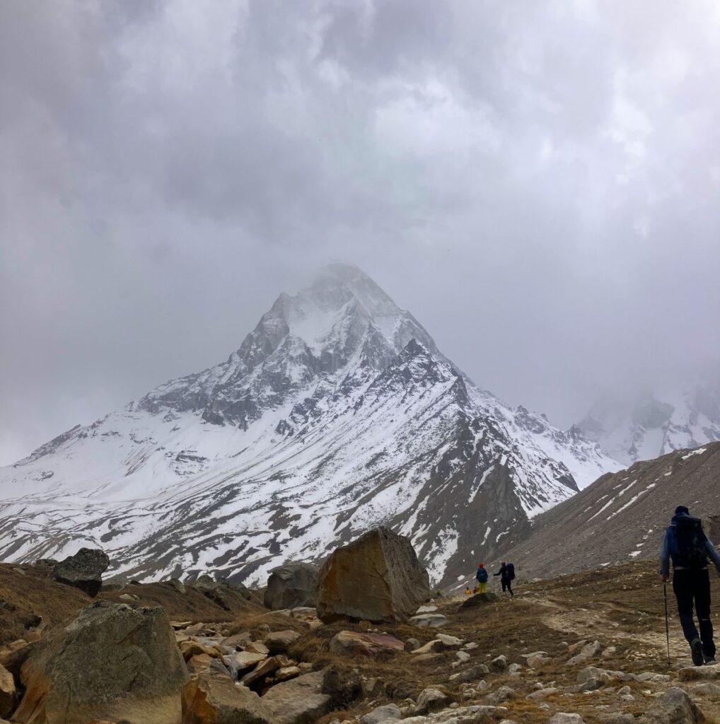
After sometime it’s starting snowing suddenly everything was just white and beautiful but team was a little worried as route markings would have been disappeared also if doesn’t stop there will be more chances of avalanches on higher camps however in the Mountains weather conditions are never in you control you have to take all decisions as per weather permission does not matter matter how hard you tried you may have to stay back for longer duration or step back, we were only hoping for better weather and continually asking for the weather report from Delhi using satellite phone, After sometime it stopped snowing it was already fallen more then 1 feet my Tent was covered with snow so we all cleanup the snow around the tents before the dark and had good dinner and good night
At Kedardome Basecamp
Day 10 – April 25, 2025 | 4610 meters/15124 ft | Temperature 3° to -6°C
Today was a rest day for me and Suresh, while Ankul went to Camp 1 with Guests to drop some load. Naveen also did a load ferry to a little higher than Camp 1, (ABC) and left some ropes, snow bars, at the higher than camp 1 so the team could use them for fixing ropes on the slope the next day. Afterward, the entire team and the Guest returned to base camp and discussed the weather and the upcoming days. The weather was quite fluctuating and reacting differently; however, it was very good today.
Basecamp and Camp 1 Load ferry
Day 11 – April 26, 2025 | 4910 meters/16108 ft | Temperature 10 ° to -6°C
Trek – 7km | Ascent 300 meters / 984 ft. | Duration- 7 hours
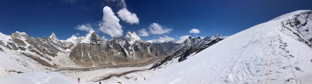
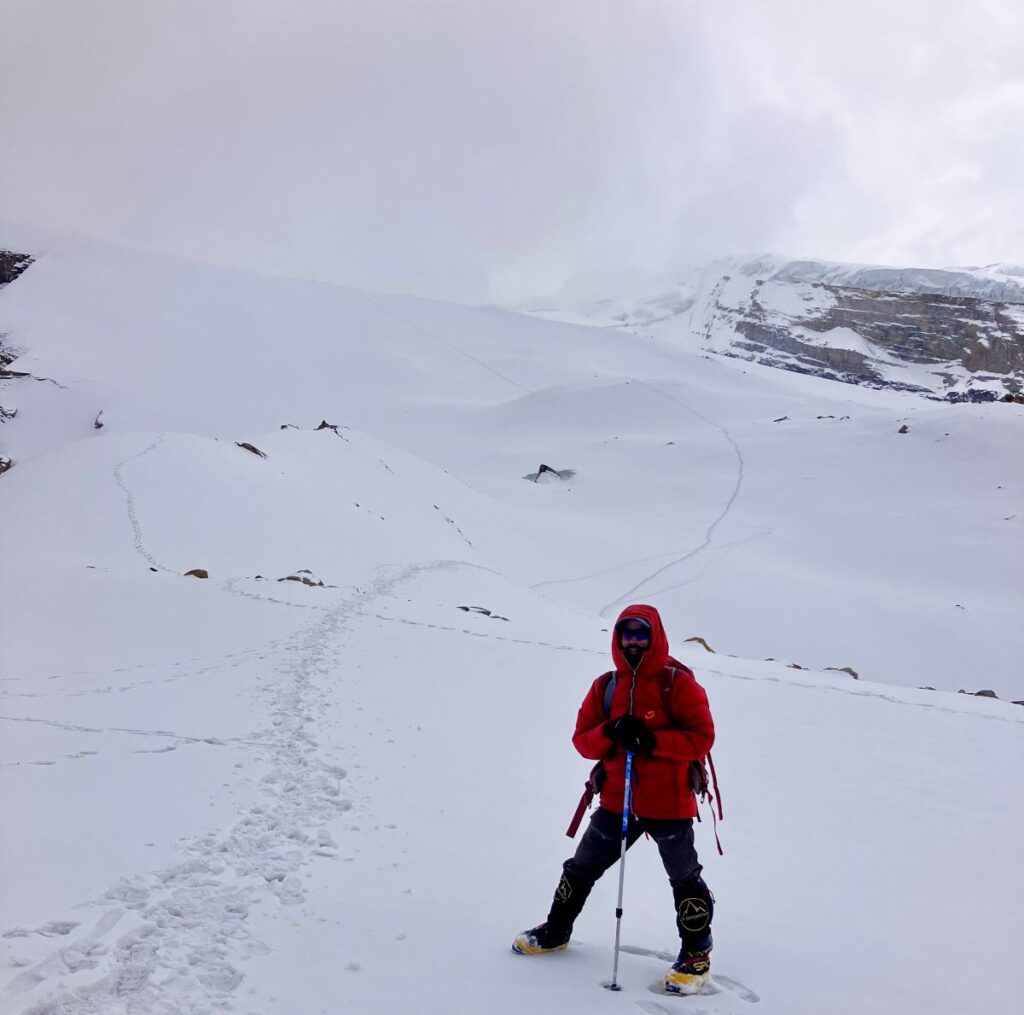
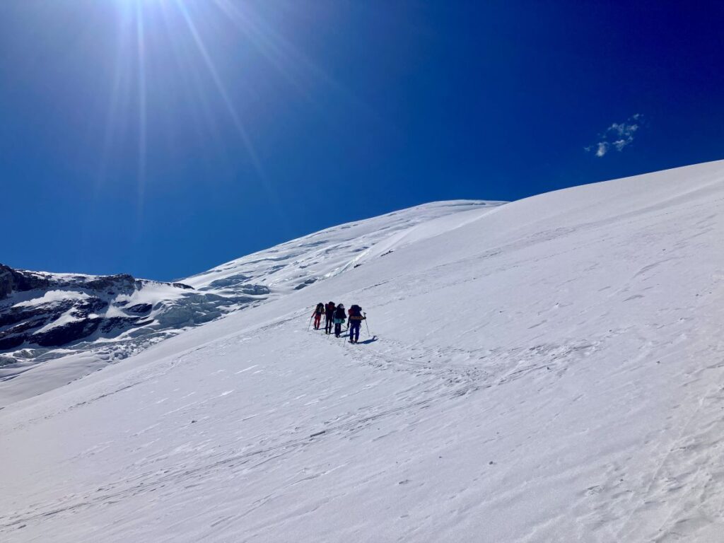
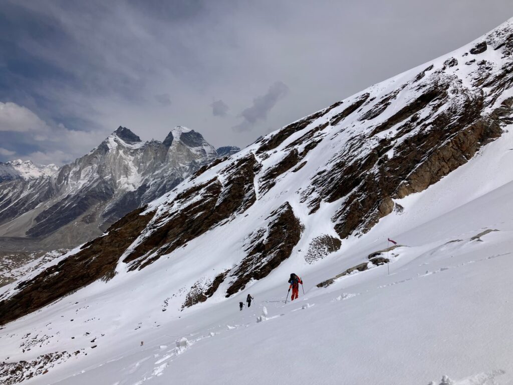
Today was a rest day for Ankul and Guest. I, Suresh, Naveen, and Govind went for a load ferry to Camp 1 at 4910 meters. It was a 3.5-hour climb through the Kirti Glacier and its slopes. This was my first day beyond base camp for the load ferry. We all loaded our equipment and began climbing toward the advanced camp. The first kilometer was quite difficult, as the trail was uphill for half a kilometer and then a steep downhill through a dangerous rockfall area. This led to the start of the glacier’s moraines—another dangerous patch where we had to walk over ice stools along the glacier cracks. A mistake or a rockfall here could cause a serious accident. We crossed this patch carefully, as we do every day. The trek across the Kirti Glacier took around two hours. Then we reached a point where the snow conditions changed, and we all put on our snow boots and kept going. After a kilometer, there was a steep, snow-covered slope. It was tiring for me, and our speed was slow. We slowly climbed the first stretch, took a break, drank some water, and took a few pictures.
We started climbing again, and after 10 minutes, another steep, longer, and tougher climb began. This was the last one for the day and took about 45 minutes of hard climbing. We finally reached the camp. This part of the climb was very tough; it was so steep, and the sun was harsh. The reflection of the sun on the white snow made it hotter and more exhausting. I was wearing a jacket, and the light was so bright. My inner T-shirt got completely wet. Once I reached the camp, I quickly unloaded my bag, got my stuff out, and arranged it. After a few minutes, I realized my sweat was getting colder, and I was feeling very cold inside and out since it was windy. I was wearing my down jacket, so I quickly took it off, changed my inner T-shirt, and then put my down jacket back on. We all pitched three tents, as the plan was to move to this camp the next day. We set up the camp, took a rest, and then returned to base camp for lunch. I had a very good lunch and then took a nap. Afterward, we had a chat with the team about how we were going to proceed.
Camp 1 Load ferry
Day 12 – April 27, 2025 | 4910 meters/16108 ft | Temperature 8° to -6°C
Trek – 7km | Ascent 300 meters / 984 ft. | Duration- 7 hours
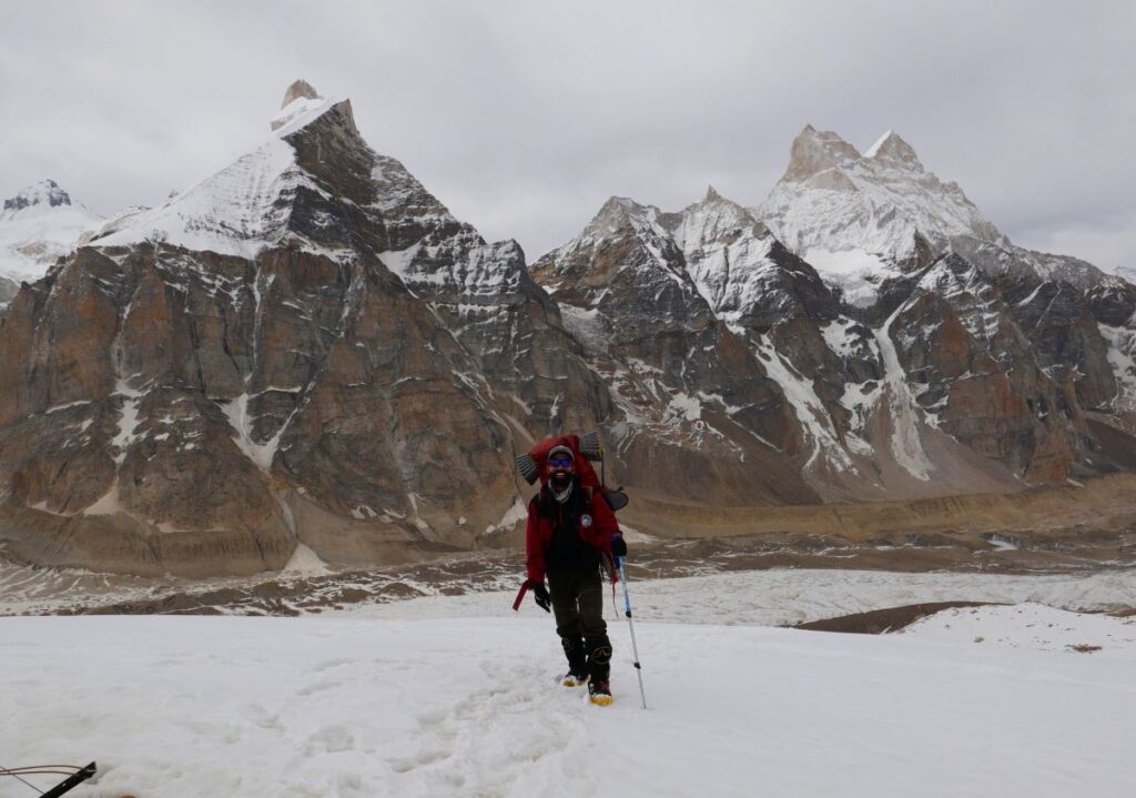
Today was a long day. We all started hiking toward Camp 1, while AMC and the Guest came using their skis. We all did a load ferry to Camp 1. Naveen, Ankul, Govind, and the Guest spent the night there so they could open the route to the higher camp and ski around the next day. Suresh Dai and I came back to the base camp and had lunch. I took a nap and woke up for a cup of tea in the evening. It was amazing outside—one of the best sunsets I’ve ever seen in this valley. The golden sunlight reflected on Bhagirathi 1, 2, and 3.
Load fairy to camp 2
Day 13 – April 28, 2025 | 5300 meters/ 17388 ft | Temperature 8° to -6°C
Trek – 9 km | Ascent 690 meters / 2263 ft. | Duration- 7 hours
Suresh and I did another load ferry to ABC, while Ankul, Naveen, and Govind also opened the route to a point just before summit camp. The Guest followed them to that point. Suresh and I shifted some gear to Camp 2 (300 meters higher), as the plan was to move there in two days. All the climbers met at this point. We cleared some snow and pitched a tent to keep all the gear inside. Then we all walked down to ABC and had a cup of tea, while the Guest skied down to ABC (Camp 1). Suresh, the Guest, and I started heading back to base camp, while Ankul, Govind, and Naveen stayed behind to fix the ropes on the remaining slope, which was going to take another three days. We reached base camp around 4 p.m., and the Guest arrived around 5 p.m.
Day 14: April 29 The Austrian team and I rested today while Suresh Dai did another load ferry early in the morning to Camp 1 and fixed the rope beyond the summit camp. All climbers returned to base camp. After checking the weather report, we learned that the weather on the planned summit days (May 3rd and 4th) would not be good. This meant we had to attempt the summit on May 2nd, but the rope fixing was not yet completed beyond summit camp. After a lot of discussion with the climbing team, everyone agreed to shift to Camp 2, changing the plan from moving the day after tomorrow. This was quite a tough decision, as tomorrow was supposed to be a rest day for the climbers. We all slept at the base camp today.
Load fairy to camp 2
Day 15 – April 30, 2025 | 5300 meters/ 17388 ft | Temperature 2° to -8°C
Trek – 9 km | Ascent 690 meters / 2263 ft. | Duration- 6 hours
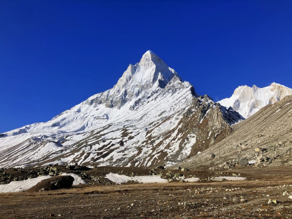
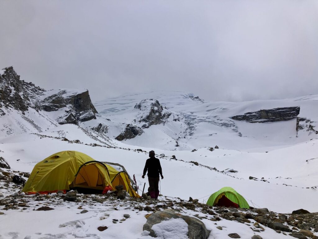
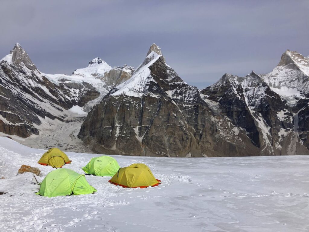
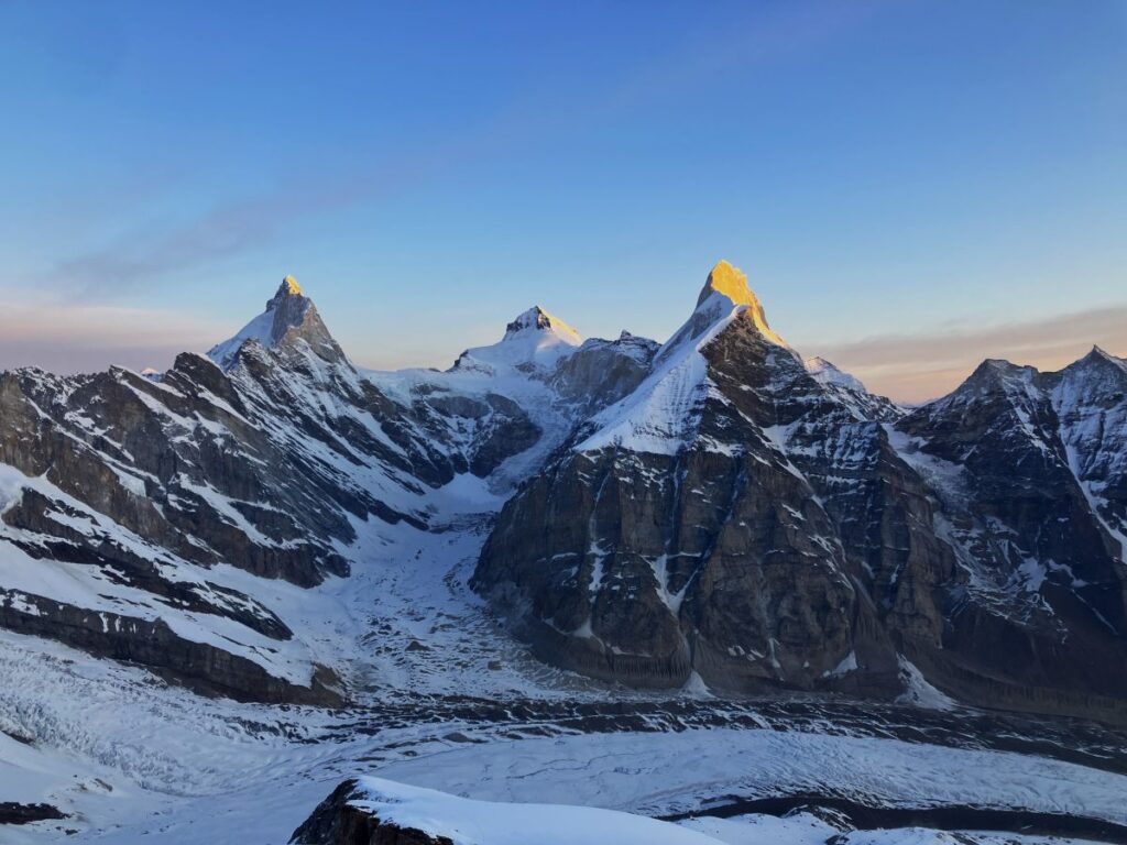
However original plan for all member was to rest at base camp today but after a little change in a plan we all got ready to shift at Camp 2 (5200 M) Naveen had to go Gangotri for some important work, while me and rest climber shifted to Camp 2 with all Austrian Team it was long and tough 8 hours of climb finally we all reached camp 2 around 4 pm we all pitched the tents melted some snow for water to cook dinner camp 2 was placed up on the slope of Kedardome on a clear patch this is an outstanding location Mt. Bhrigupant, Mt. Meru, and Mt. Shivling was visible right behind the other side of the Kiti glacier valley while facing the peak. Suresh, Naveen, Govind were sharing a tent. We adjusted the gear and stuff inside, we had a cup of tea and warm water to eat Sattu, we all slept early as the next day was long and hard.
Day 15 (01-May) We woke up around 7 a.m. and started packing our gear. The morning view from Camp 2 was amazing, and it was incredible to be there. After packing,

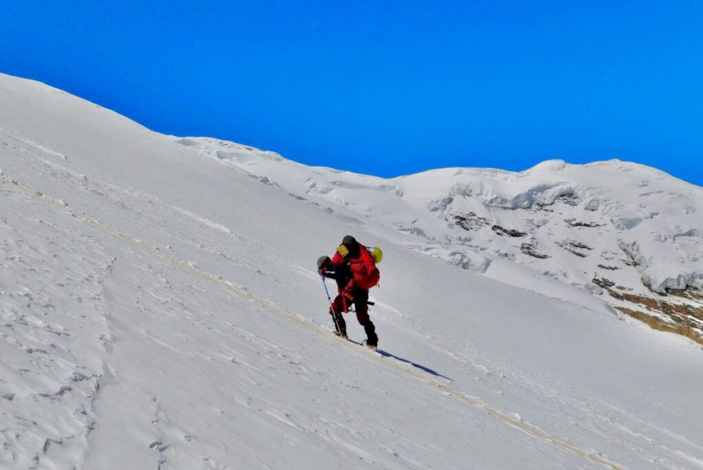
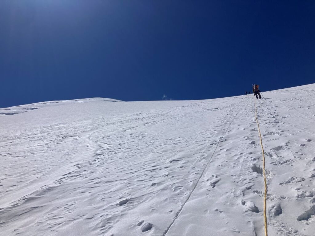
we started climbing the slope further. The rope was already fixed on the ridgeline above. The climbing team started climbing the 60-degree vertical slope with the fixed rope since this was an avalanche-prone area. The ski team, however, started climbing the zigzag uphill with their skis. The sun was very intense, making the slope quite difficult. It took us around two hours to reach the ridge. I was trekking behind the climbing team, and the guests were climbing a little behind me in a zigzag pattern. I took a break on the ridge and had an energy bar and some water. On this climb, the view was getting better and better. After another 1.5 hours of climbing, I finally reached the point where the other team members were already waiting.
Suresh decided to set up the summit camp here. I suggested we wait for the rest of the team to arrive and decide where to set up the camp. The original plan was to set the camp at 6,100 meters (20,000 feet), and this was at 6,800 meters. Suresh said there wasn’t a good place to camp on the upper slope at 6,000 meters; they had already checked. He said the ice was very hard and the wind would be very strong at night since that patch was on the ridge. However, this spot was covered from at least one side. I agreed.
When the guests arrived, they didn’t want to set up the camp here because the next day would be more than a 1,000-meter gain. After a long discussion, the team decided to camp here and start early, around 1:00 a.m. But there was one challenge for tomorrow: the rope was only fixed until 6,200 meters. Suresh and the team decided to move ahead earlier to fix the rope. We would catch up with them, and the rest of the rope would be fixed as we climbed.
We set up the camp and started melting snow to get water to cook dinner. I hadn’t eaten well since morning because my appetite was low due to the elevation gain. I only had a cup of tea and a little soup. The climbing team went to fix more rope before evening so there would be less work for tomorrow. I also climbed 100 meters.
Day 16 (02-May) Attempt to the summit
The summit day started around 1:30 a.m. It was cloudy outside, the temperature was around -15°C, and there was no visibility. It would have been difficult to fix the rope in such conditions, so the team waited until it cleared up. It was freezing cold, so we decided to stay inside our sleeping bags. Around 3:30 a.m., it started clearing up. Suresh Dai melted water and made tea for everyone. I was inside my sleeping bag, so I asked him to save some for me, and I would have it when we left camp. Suresh, Govind, and Ankul left around 4:00 a.m. and asked me to leave with someone from the Skei team.
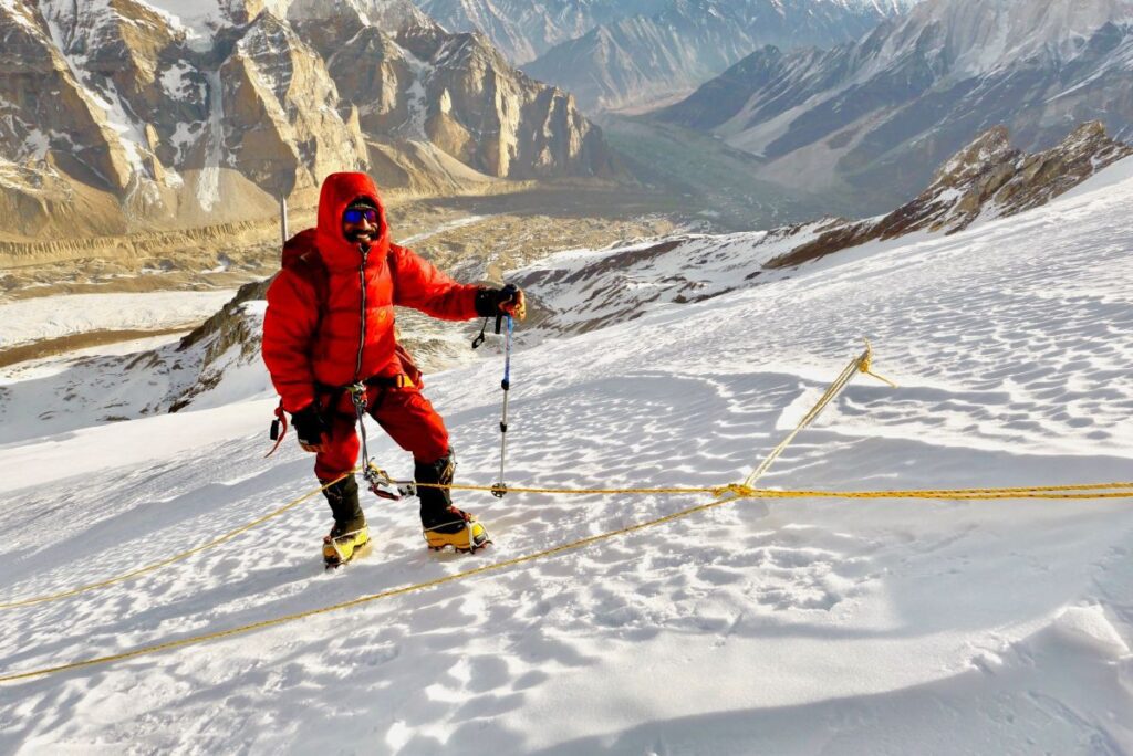
I woke up around 4:30 a.m., melted some snow for water, and had a cup of tea. I wanted to eat something but couldn’t, as I was feeling a mild headache and had a low appetite—signs of mild Acute Mountain Sickness (AMS). However, I was feeling good physically, so I thought maybe after climbing for a few hours, I would feel hungry, and then I could eat and drink more water. I packed some biscuits and energy bars, put on my feather jacket, snow boots, and crampons, and with all my gear, I came out. It was dark, but all the peaks were visible by that time. All the guests were ready, so we left around 4:45 a.m. While wearing my crampons, I took my gloves off to adjust the straps. Within a minute, my fingers started freezing, and I lost all sensation. I used my armpits to warm my fingers and then put my gloves back on.
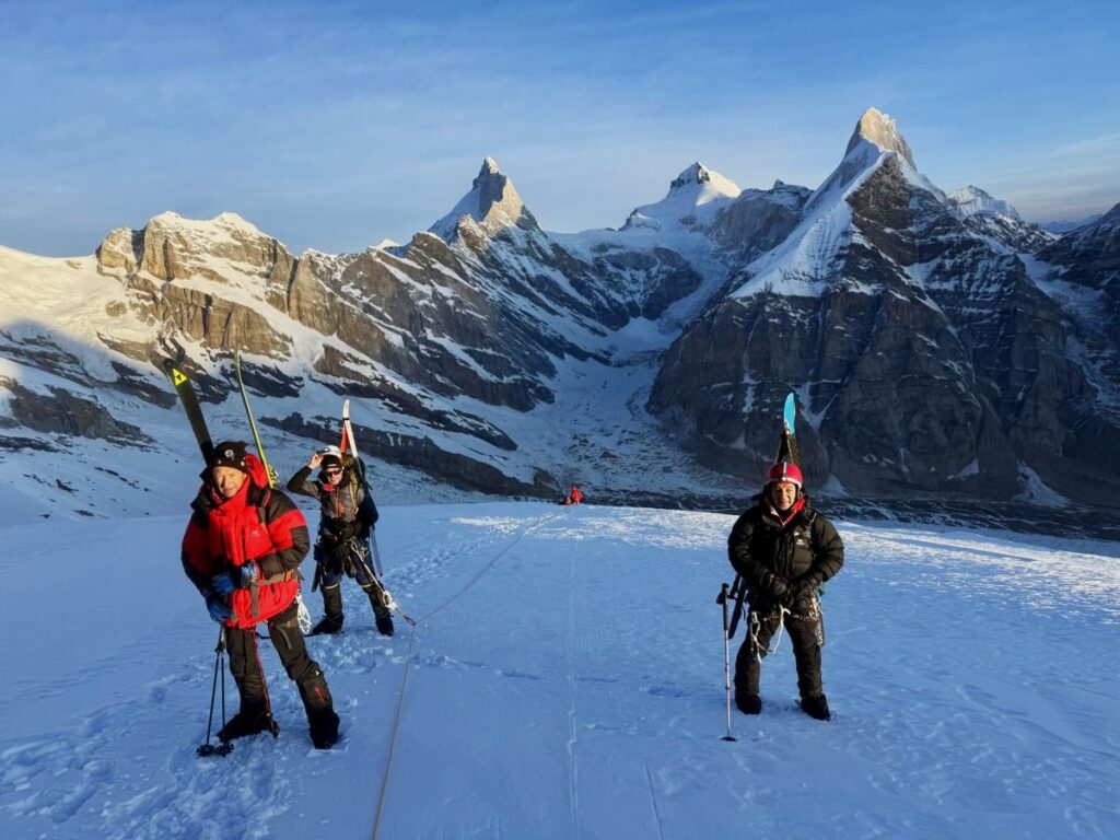
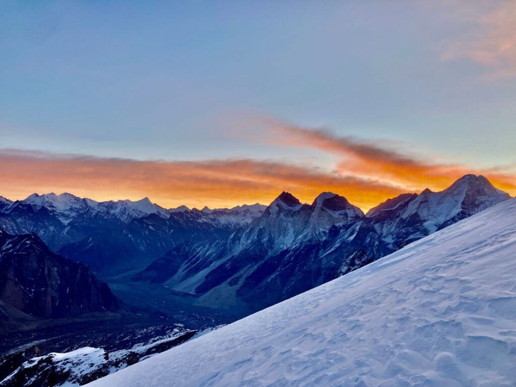
I started climbing, following the ridge. The temperature was around -15°C. I was the last person in the line. After 30 minutes, the morning light appeared, creating a golden effect on Kedarnath and Bhagirathi 2. Slowly, the view became brighter. After gaining about 150 meters, I looked around, and the view was one of the best I had ever seen in my life. It’s difficult to describe. While climbing the slope, I turned around and saw Mt. Bhrigupangh, Meru, and Shivling with golden effects on their tops. As I was at over 6,000 meters, the peaks were visible at my eye level. I thought of capturing the view on my phone, so I took my gloves off since it wasn’t possible to operate the phone with them on. I recorded some glimpses of the surrounding view; it was amazing. However, it is not possible to describe them in words, but here I have attached some YouTube videos I recorded that day. Then, I put my gloves back on. A cold sensation stuck in my fingers, and it felt like hundreds of needles were poking them. It was so painful. I put my fingers in my armpits to provide body heat and put my gloves on again, but my fingers were still freezing cold. I was just waiting for sunlight. After 20 minutes, the sunlight provided comfort.
The team reached a point and took off their skis, as the icy conditions beyond that point made it impossible to continue with skis on. They attached their crampons and proceeded with the climb. After reaching 6,200 meters, Ankul was saying something from the middle but I couldn’t hear it, so I asked him to come a bit lower. He came a little lower and said there was a news update from the base camp saying the weather would not be good after 12:00 noon. It was already 9:00 a.m., and the most tricky part still needed to be negotiated—almost 4-6 hours of the journey to the summit and 3 hours to return. Secondly, the rope might not be enough to reach the summit, as there were so many crevasses up there, including some hidden ones. When I told the lead member about the weather situation, he said, “Let’s climb until 11:00 a.m. and then see if it’s possible to hit the top.” I thought that instead of going up in such a difficult and risky situation, it would be better to descend safely and attempt it the next day. I waited for a while, thinking about what to do. After some time, I got the news from the lead climber that the rope had run out, which meant it wasn’t possible today. I and one of the guests, who was also feeling a little weak, started descending to the summit camp
A Harrowing Descent and a New Perspective
After reaching the summit camp, I had some water and rested for a while. Naveen arrived with some rope from base camp. I wasn’t feeling well; the last 24 hours had been hectic, I hadn’t eaten well, and I wasn’t fully acclimatized. I messaged base camp and the climbing team, informing them I was descending before I became sicker. I packed my bag and started heading down alone while the rest of the team descended to summit camp.I felt weaker as I descended, but after reaching the Kirti Glacier, I felt a little better. It was an easier trek, having descended 1,500 meters. I changed my boots and reached base camp. I was hungry and had a heavy lunch. Manohar told me the rest of the climbing team was also descending and not attempting the summit again. The entire team arrived in the evening.
The team leader was very upset because there wasn’t enough rope. This was a detail the climbing team was supposed to have planned. Suresh explained that they hadn’t expected so many crevasses up there, and there weren’t enough days to move the lower ropes higher. The leader retorted that they should have set the summit camp at 6,100 meters and pitched it at 4,900 meters. The debate went on for a long time.
I spoke to the team about the situation. I admitted that the climbing team should have planned better, but the weather had also been poor on May 3rd and 4th, so we had lost our opportunity for another attempt. They were not happy, but I told them that in the mountains, everything doesn’t always go as planned. Sometimes we can only give our best, and we have to leave the rest to the weather; our calculations often go wrong. I suggested we have dinner and rest. They asked if we could move directly to Gangotri the next day. Maddy said he would have to ask the porters to come tomorrow and that it would be possible to leave base camp the day after. The Journey Home from Kedar dome expedition
Day 17 – on 3rd of May The entire team cleaned up and packed their gear. Twenty porters reached base camp around 8:00 PM. We had dinner, and everyone was ready to leave.
Day 18 on 4th May – We all woke up at 7:00 AM. The plan was to reach Gangotri today, which was a very long journey. The original plan was to reach Bhojbasa and then Gangotri the next day, but our guest wanted to reach the road head as soon as possible. I, Govind, Ankul, Naveen, and the guest started descending.
Maddy, Suresh, and the kitchen team had to wrap everything up and would leave later. After an eight-hour journey and a 1,200-meter descent over approximately 20 kilometers, we reached Gangotri. We had no communication with the base camp team and no idea where they had reached. I received thousands of messages and missed calls on my phone, as I had been offline for the last 12 days. We were told to check in at Mandakini Guest House and have dinner. Our base camp team might camp at Cheerbasa or come directly to Gangotri. We were all tired. We had a cup of tea, visited the Gangotri temple, had dinner, and went to sleep.
Day 19 In the morning on 5th, we learned that the base camp team had arrived around 1:00 AM. After breakfast, we loaded all our gear onto a minibus. We had lunch at Shikhar Resort and dinner at Neeraj Bhawan Resort in Rishikesh. After a 10-hour drive, we all reached Rishikesh. We had dinner together and said goodbye to each other. My plan was to leave for Delhi, while the guest planned to explore Rishikesh and go rafting.
Day 20 The next day on 6th of May, I left for Delhi with all the equipment in an XUV. I was scheduled to report to the IMF. On the way to Delhi, the driver told me there had been a big terrorist attack in Pahalgam, Kashmir, and there were chances of war. I was shocked and horrified by the news. I submitted my report to the IMF in the evening and left for Dehradun the same night. After such a long and adventurous journey, I reached home with many memories from the mountains.
Reflection
Kedar dome expedition, though it did not end in a summit, was a profound experience. It was a powerful reminder that while we can prepare meticulously, the mountains ultimately have the final say. The true spirit of climbing isn’t just in reaching the top, but in the journey itself—in overcoming challenges, learning to adapt, and finding strength in unexpected places. The memories forged and the lessons learned are far more valuable than any summit. Here’s to the next adventure! 🏔️


Subscribe | Like | Follow | Write to Us
